Satellites & Bleaching

5km Sea Surface Temperature (SST) Trend Product

previous page next page
CRW Global 7-day SST Trend for Aug 11 2020

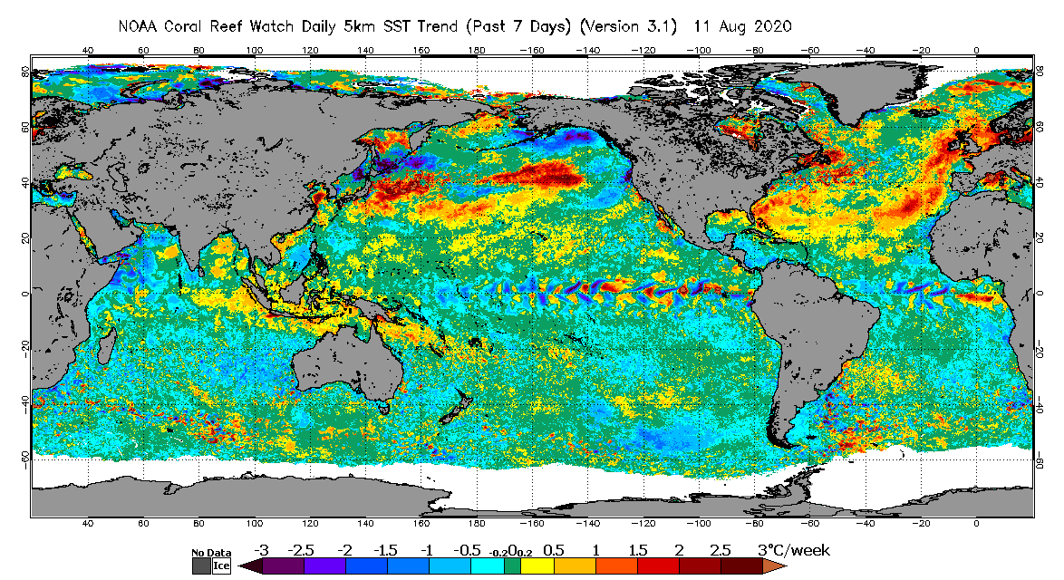
Shown here is an example daily global 5km satellite SST Trend product map for August 11, 2020. The temperature trend color scale is shown along the bottom of the map image, and ranges from -3.0 to +3.0 degrees Celsius (°C) per week. Each color gradation on the temperature scale is 0.5 °C. Satellite pixels colored in green, within the range -0.2 to 0.2 °C, have insignificant trends. Land is colored in gray. An ice mask (colored in white) is also incorporated, courtesy of the United Kingdom Meteorological Office (Met Office) and the NOAA National Centers for Environmental Prediction (NCEP). Click the image to view a larger version.

NOAA CRW's daily global 5km satellite 7-day sea surface temperature (SST) Trend product provides information on the near-term pace and direction of SST variation, and thus coral bleaching heat stress, over the past seven days. Seven daily 5km CoralTemp SST measurements for each satellite pixel are included in the calculation used to derive the product images. Trends are checked statistically with the two-tailed Student's t-test for the 20% significance level with five degrees of freedom. Satellite pixels colored in green have insignificant trends due either to small SST trends (within the range -0.2 to 0.2 °C) or trends that failed the statistical test. Data and images are available for free on the CRW website at https://coralreefwatch.noaa.gov/product/5km/index.php.


previous page next page


(top)

NOS Web site footer