

|
|
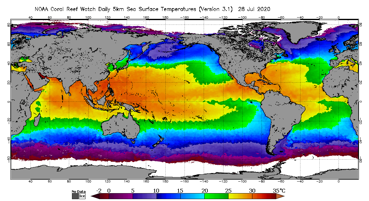
As of May 1, 2020, NOAA Coral Reef Watch's (CRW) coral bleaching heat stress monitoring officially entered a new era with its next-generation, operational daily global 5km (0.05 degree) coral bleaching heat stress monitoring products (Liu et al., 2014). The first of these products, known as CoralTemp, is a gap-free global sea surface temperature (SST) product, produced daily at a 5 kilometer (km) spatial resolution that spans January 1, 1985 to the present. The data are shown in "pixels" (picture elements), which are approximately 5km on each side. The CoralTemp SST product is quite straightforward. It provides a measurement of the nighttime ocean temperature at the sea surface, calibrated to 0.2 meters depth, all around the world. CoralTemp is derived using a combination of three, level-4 (i.e., gridded and gap-filled analysis) nighttime-only satellite SST datasets, which are produced daily and gridded at the same 0.05-degree spatial resolution. These are the:
For more information, please see the detailed description on our 5km methodology web page. CoralTemp's nighttime SST measurements provide more stable estimates of heat stress conducive to coral bleaching by reducing the influence of daytime warming caused by solar heating at and near the sea surface, and to avoid contamination from solar glare. Furthermore, at night, water temperatures at and near the sea surface are more vertically uniform. Below is a schematic of the 9 satellites (5 geostationary [orange] and 4 polar-orbiting [blue], updated July 18, 2023) that contribute data to the daily global 5km CoralTemp SST product: 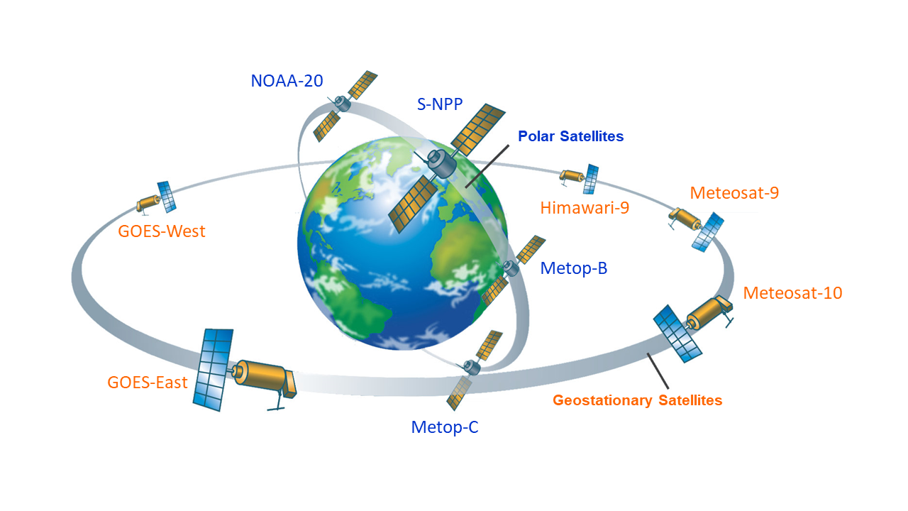
In the near future, we look to add data from multiple additional satellites to the CoralTemp SST product. The satellites include
Sentinel-3A and Sentinel-3B CoralTemp is one of the best and most internally consistent daily global 5km SST products currently available. It is updated each afternoon at about 12:00pm U.S. Eastern Time. Data and images are available for free on the CRW website at https://coralreefwatch.noaa.gov/product/5km/index.php.
|
|||||||||||||||
|
|
||||||||||||||||