
|
|
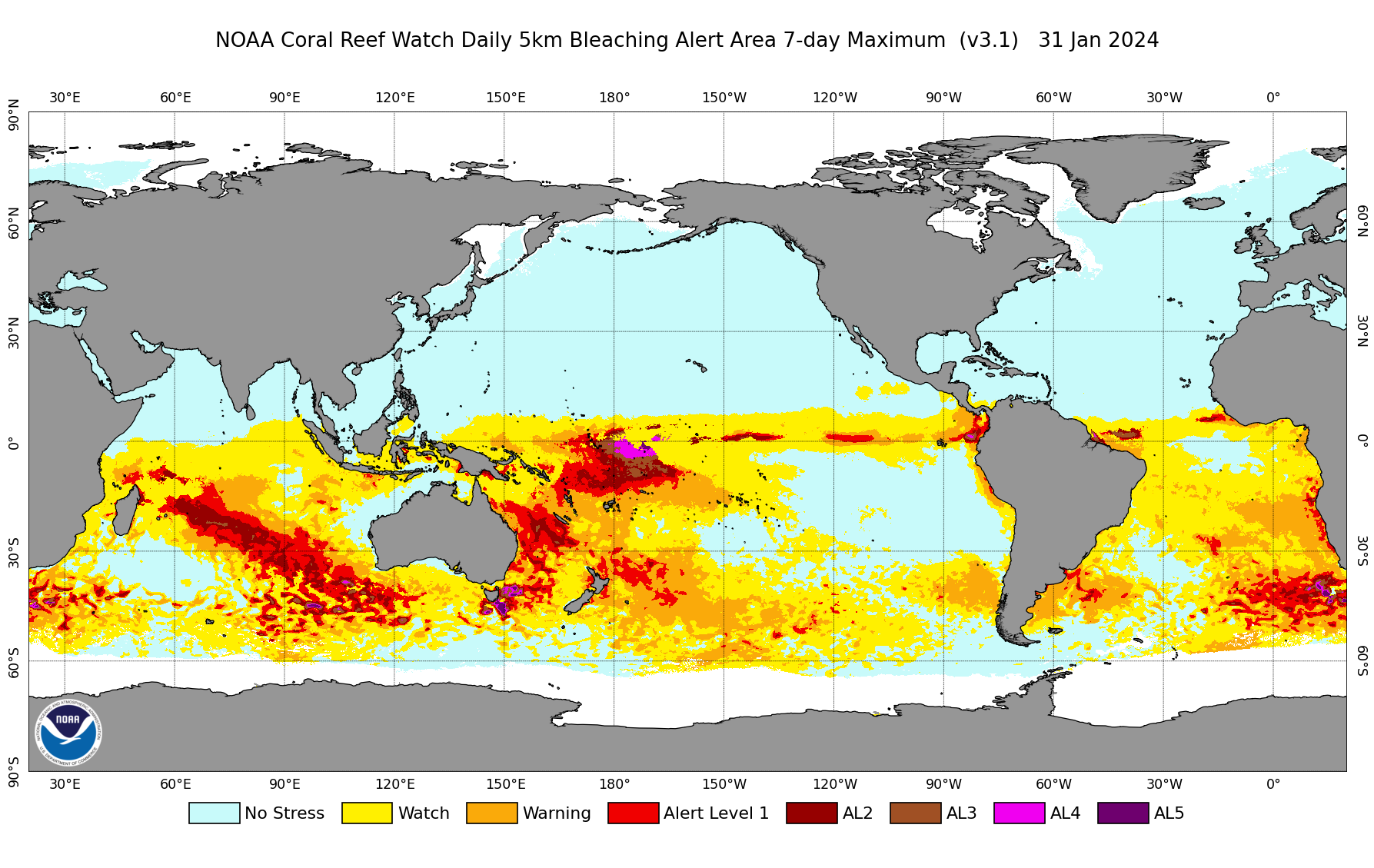
NOAA CRW's daily global 5km satellite coral Bleaching Alert Area product outlines the areas around the world where coral bleaching heat stress currently reaches various levels, based on CRW's satellite sea surface temperature (SST) monitoring. When developing the daily global 5km Bleaching Alert Area product, CRW first created a Bleaching Alert Area single-day product. It is derived from a combination of CRW's daily global 5km satellite Coral Bleaching HotSpot and Degree Heating Week (DHW) products. So, in the Bleaching Alert Area single-day product, the heat stress level at a 5km satellite data grid, on any day, is based on both the daily global 5km HotSpot and DHW values for that day.
CRW's coral bleaching heat stress levels are defined in more detail in the following table (updated in December 2023 to
include the new Bleaching Alert Levels 3-5). 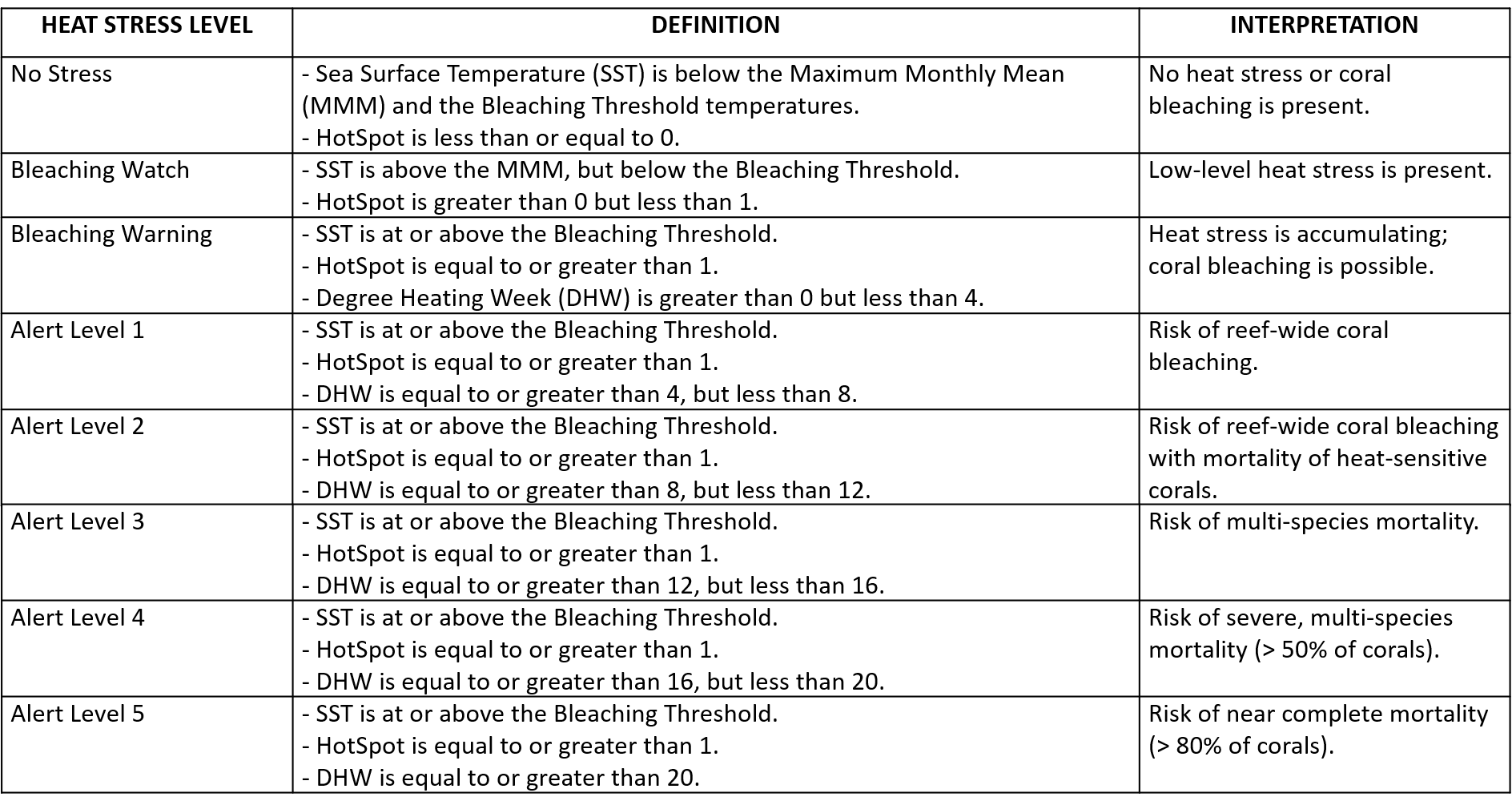
However, SST variability is often considerably higher at the much finer 5km spatial and daily temporal resolutions, when compared with CRW's heritage twice-weekly global 50km coral bleaching heat stress monitoring products. Due to day-to-day fluctuations in heat stress levels in highly variable locations, the daily global 5km Bleaching Alert Area single-day product does not consistently and adequately identify potentially harmful heat stress levels to corals, especially with regard to accumulated heat stress impacts. For that reason, CRW also developed a Bleaching Alert Area (7-day maximum) composite product. The 7-day maximum composite product is featured as the main Bleaching Alert Area product on the CRW website (and is displayed as the example daily global 5km Bleaching Alert Area product map above, in the top right corner of this section). The Bleaching Alert Area (7-day maximum) composite product is updated daily -- after each of the corresponding, seven Bleaching Alert Area single-day products are updated. For each satellite pixel, the 7-day maximum composite product shows the highest heat stress level experienced during the most recent seven consecutive days (as shown by the corresponding, seven Bleaching Alert Area single-day products). Data and images are dated on the last day of that 7-day period, and are available for free on the CRW website at https://coralreefwatch.noaa.gov/product/5km/index.php. Note: while the Bleaching Alert Area single-day product is not featured on the CRW website, it is still available through the Archived Data and Images pulldown menus on the daily global 5km satellite coral bleaching heat stress monitoring products data page. To learn more about the daily global 5km satellite coral Bleaching Alert Area product, including the featured 7-day maximum composite product, please visit CRW's 5km methodology page.
|
|||||||||||||||
|
|
||||||||||||||||