


NOTICE !!!
NOAA Coral Reef Watch's operational twice-weekly global 50km satellite coral bleaching heat stress monitoring products were retired in April 2020, after being in service for more than two decades
(January 1997 - April 2020).
These products have been replaced with higher-resolution daily global 5km satellite products.
Archived 50km data and images are available on this page.
If you need assistance, please contact
coralreefwatch@noaa.gov.
(https://coralreefwatch.noaa.gov/product/5km)
NOAA Coral Reef Watch Virtual Station (26 Additional)
(Locations and Data)
(Locations and Data)
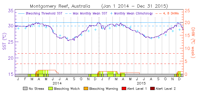
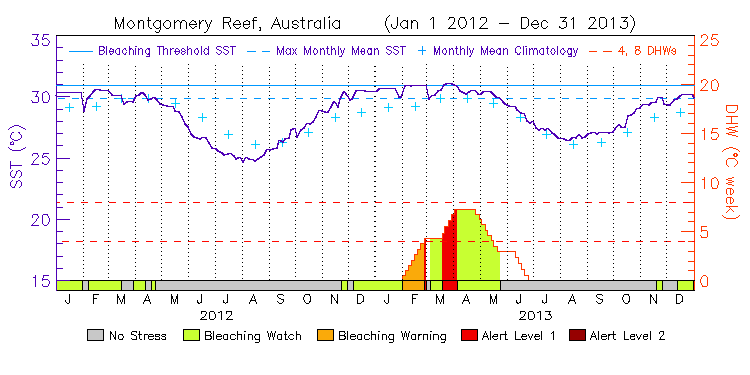
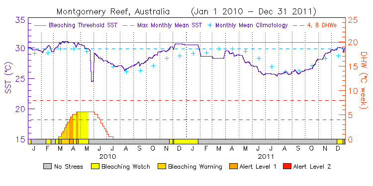
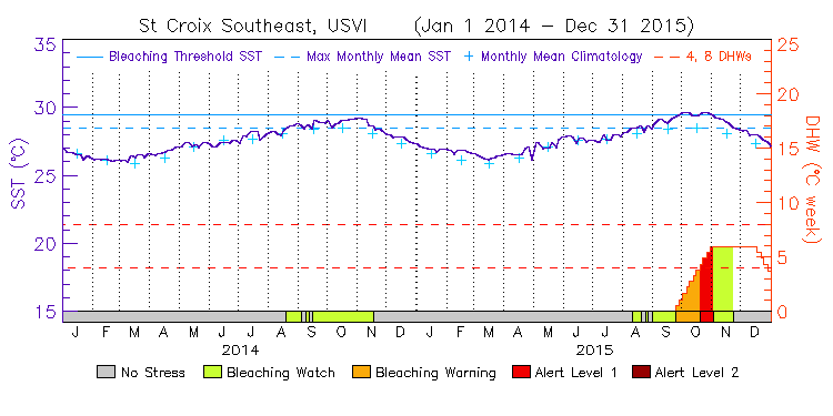
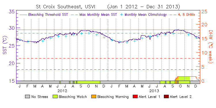
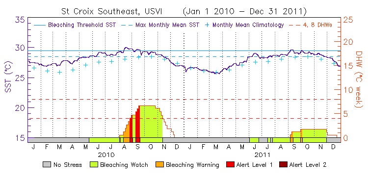
Note: While these Virtual Stations' time series data are complete for the entire 50km product temporal coverage (2000-2020), the graphs are available for 2000-2015 only.
| Station Name | Lat | Lon |
|
|
|---|
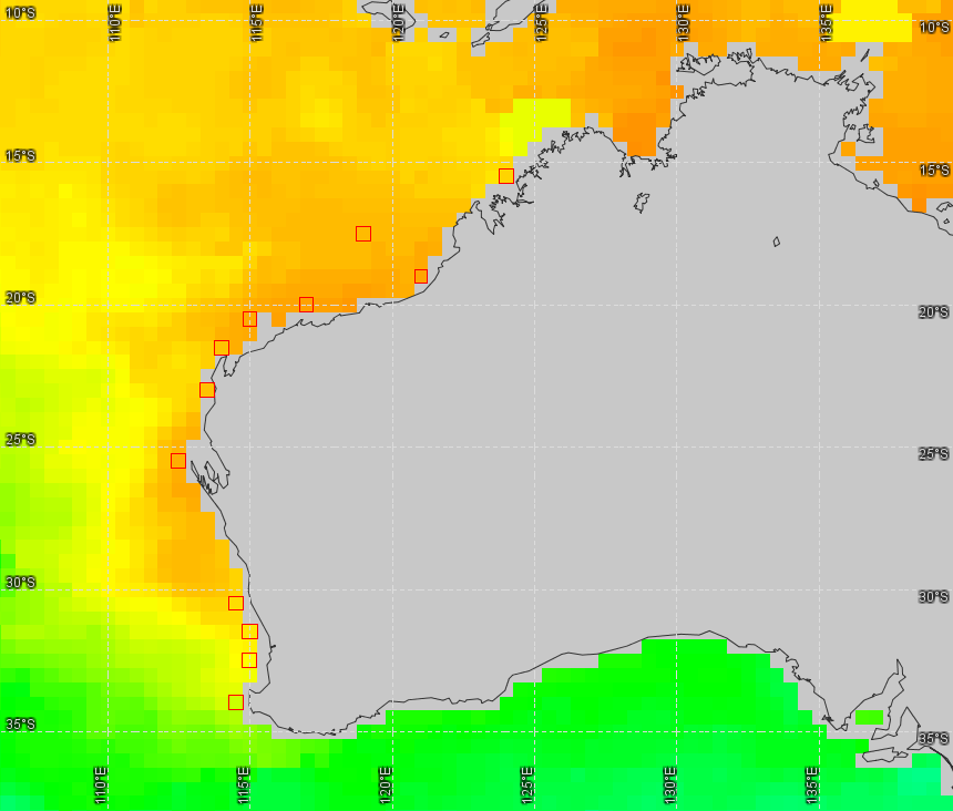
Western Australia
(12 stations, released on June 9, 2011, updated on Aug 27, 2013) ---
Virtual Station Location Map
Tropical Region
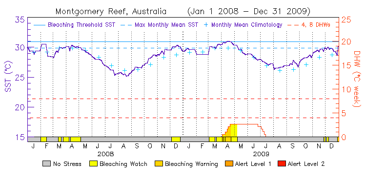
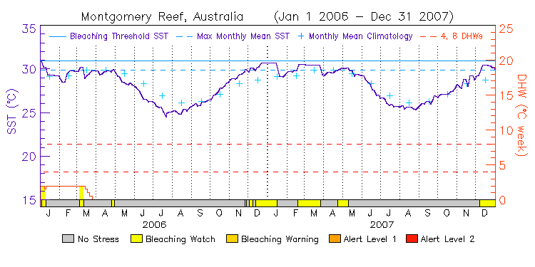
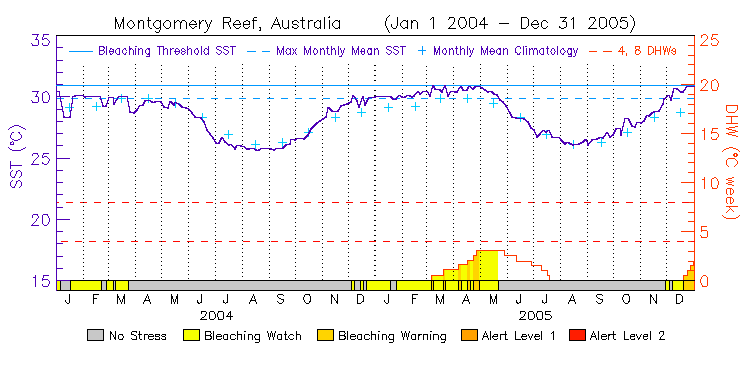
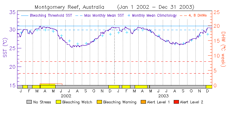
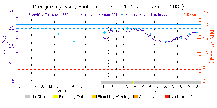
| Montgomery Reef | 15.5S | 124.0E | 14-15 12-13 10-11 08-09 06-07 04-05 02-03 00-01 | data |
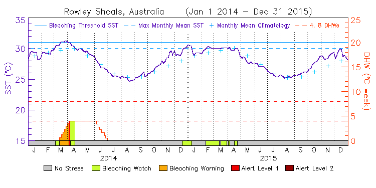
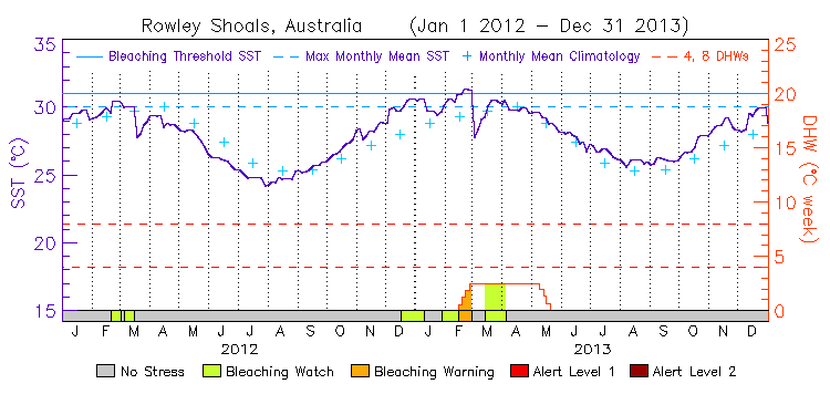
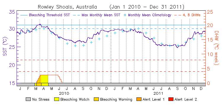
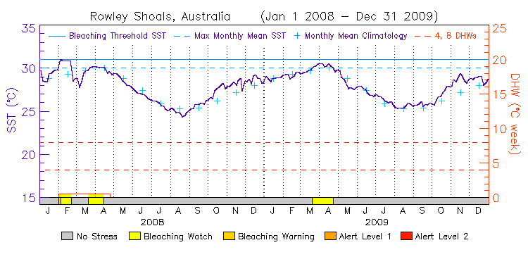
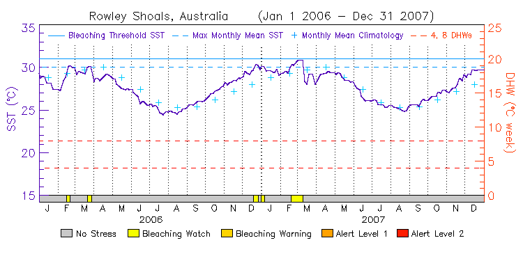
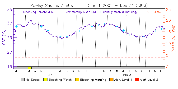
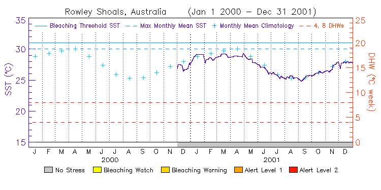
| Rowley Shoals | 17.5S | 119.0E | 14-15 12-13 10-11 08-09 06-07 04-05 02-03 00-01 | data |
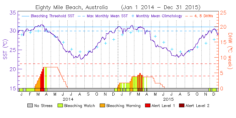
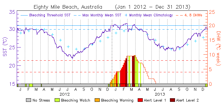
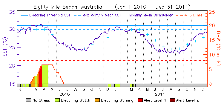
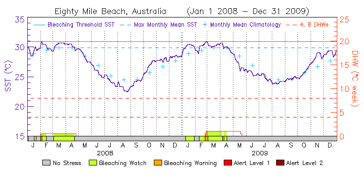
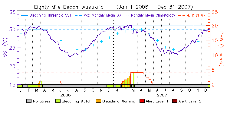
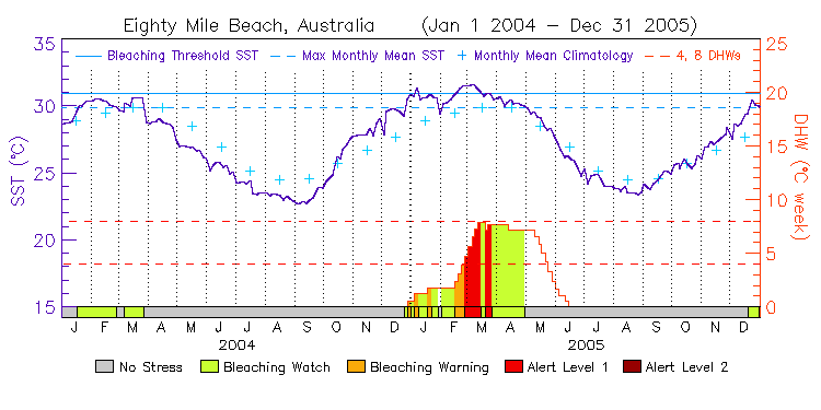
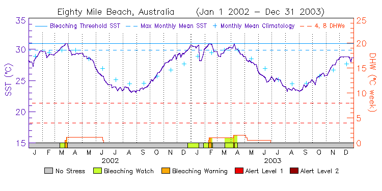
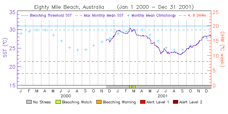
| Eighty Mile Beach | 19.0S | 121.0E | 14-15 12-13 10-11 08-09 06-07 04-05 02-03 00-01 | data |
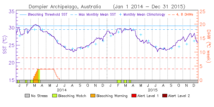
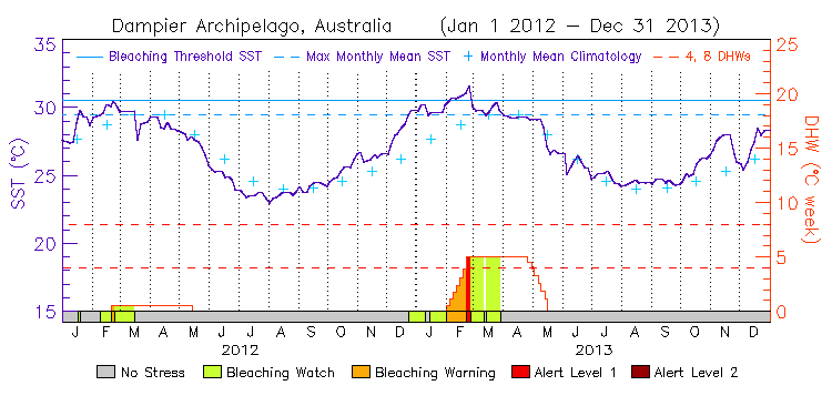
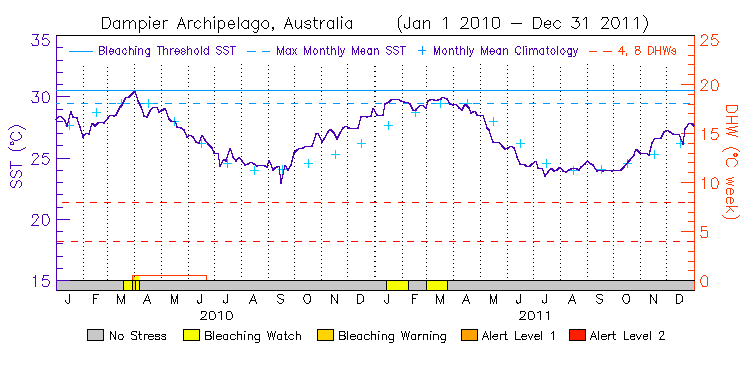
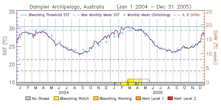
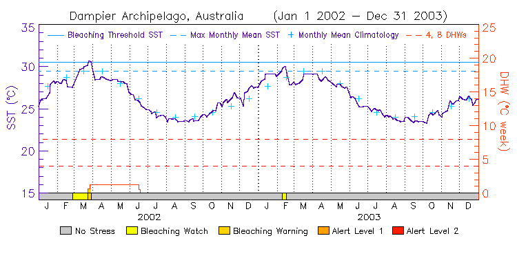
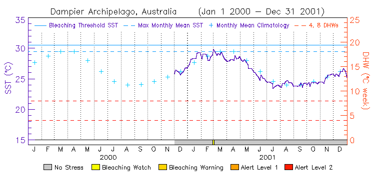
| Dampier Archipelago | 20.0S | 117.0E | 14-15 12-13 10-11 08-09 06-07 04-05 02-03 00-01 | data |
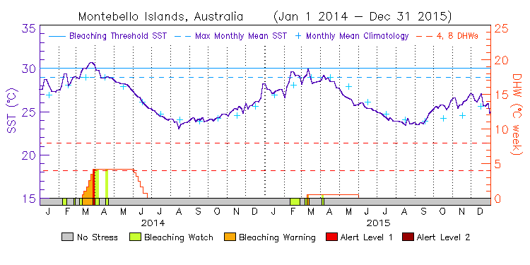
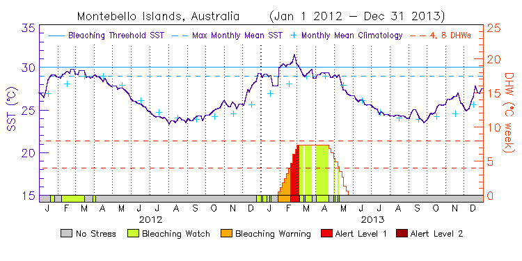
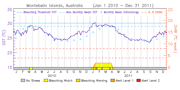
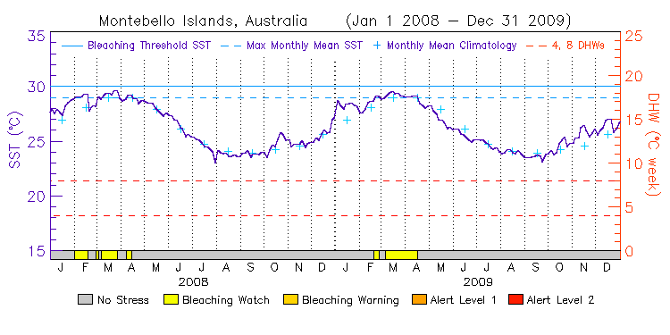
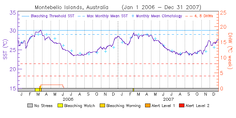
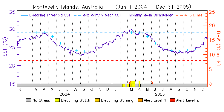
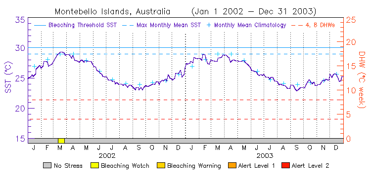
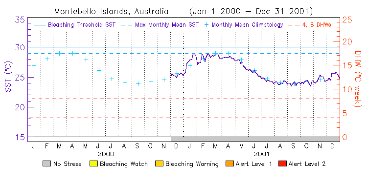
| Montebello Islands | 20.5S | 115.0E | 14-15 12-13 10-11 08-09 06-07 04-05 02-03 00-01 | data |
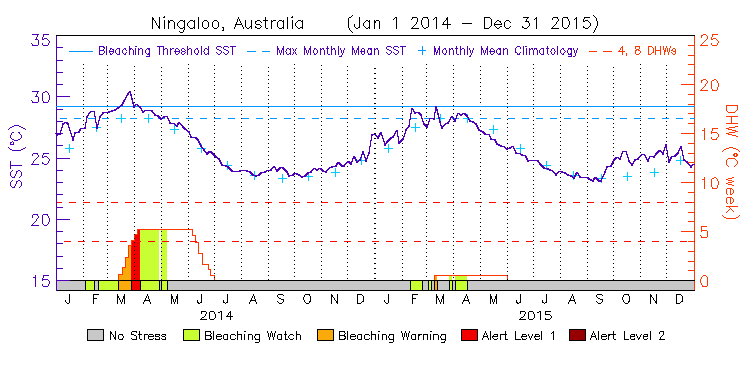
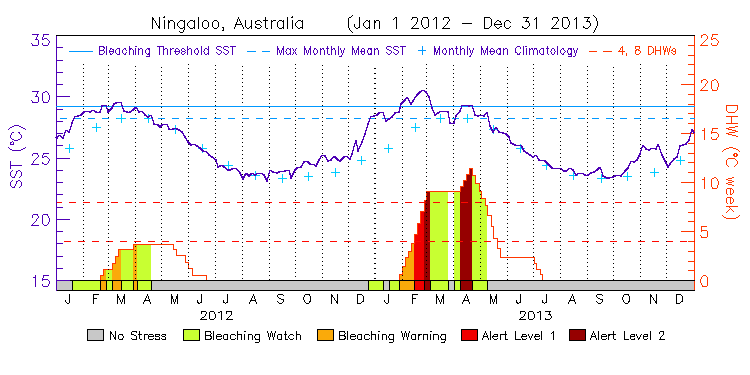
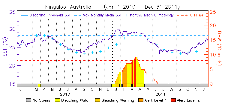
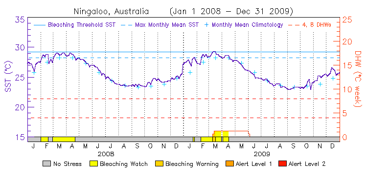
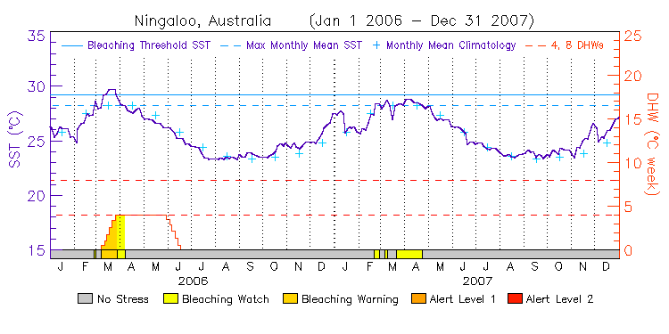
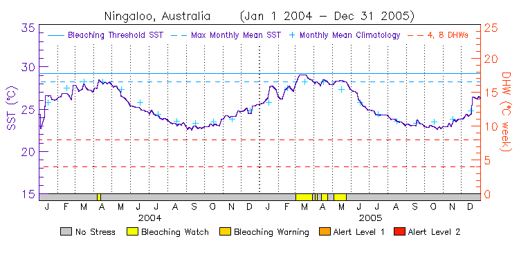
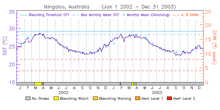
| Ningaloo | 21.5S | 114.0E | 14-15 12-13 10-11 08-09 06-07 04-05 02-03 00-01 | data |
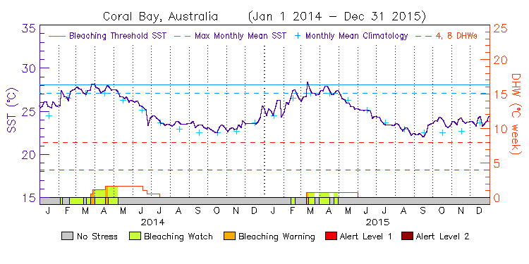
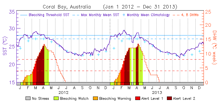
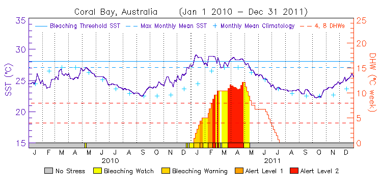
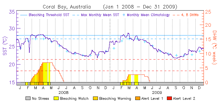
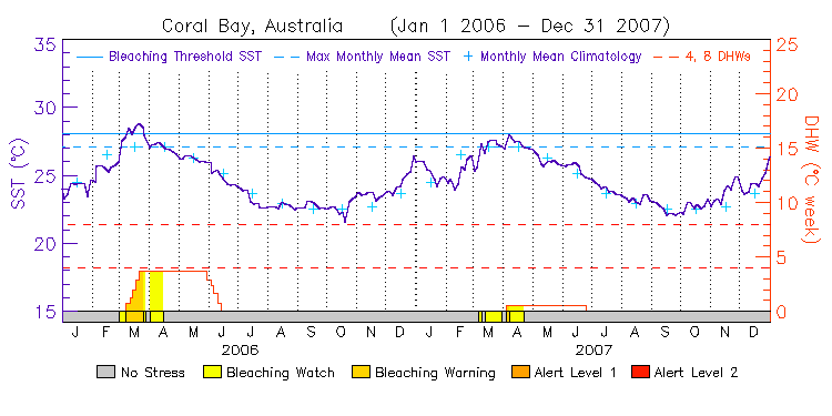
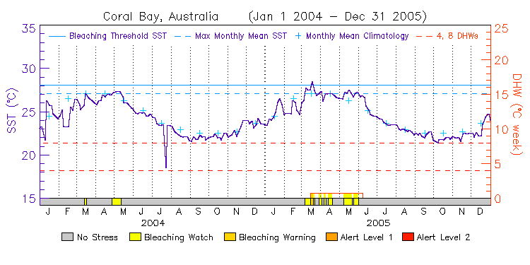
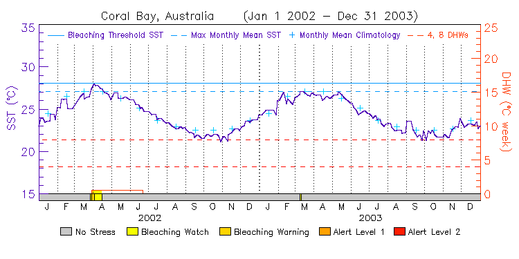
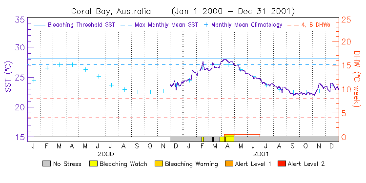
| Coral Bay | 23.0S | 113.5E | 14-15 12-13 10-11 08-09 06-07 04-05 02-03 00-01 | data |
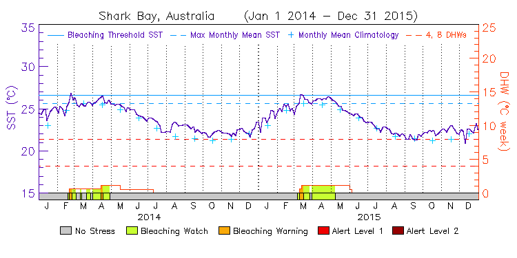
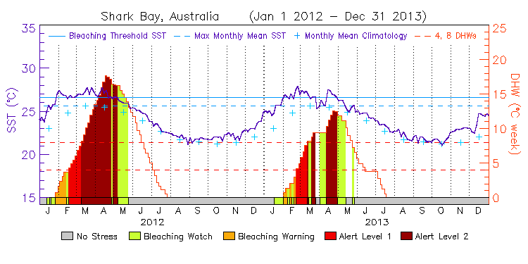
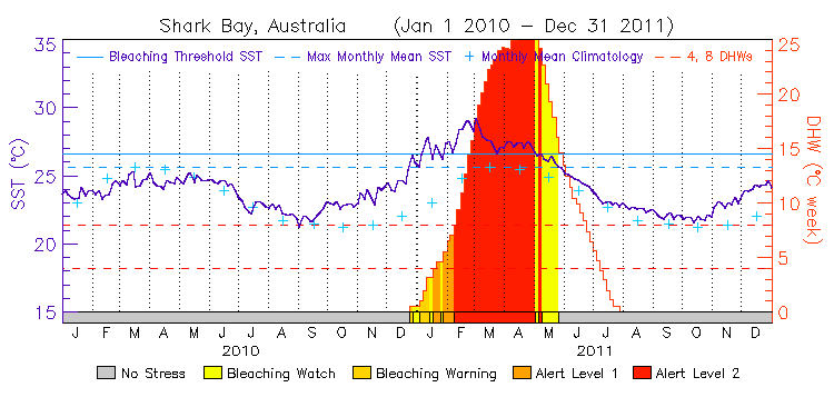
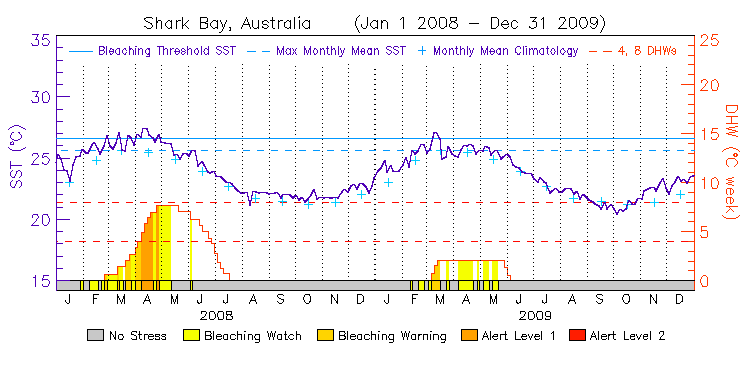
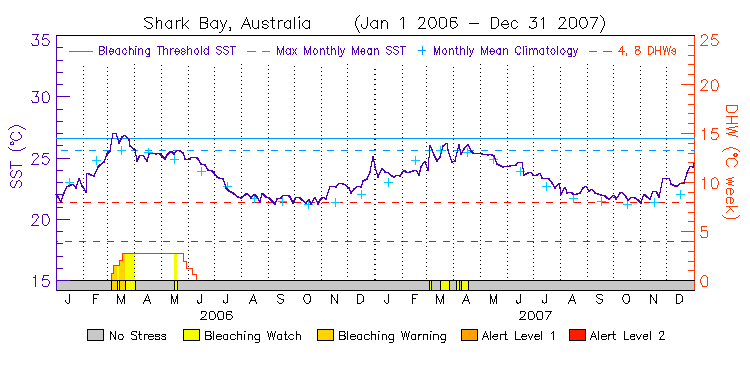
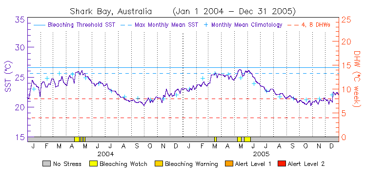
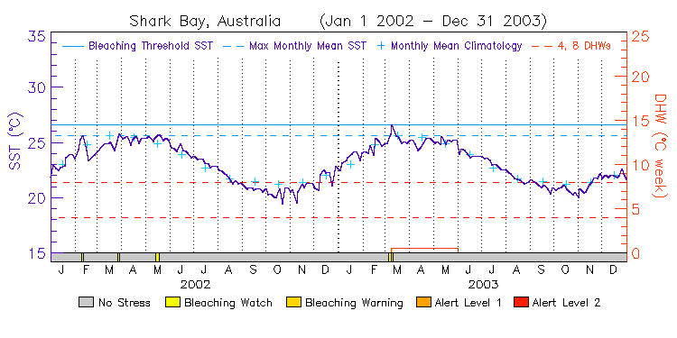
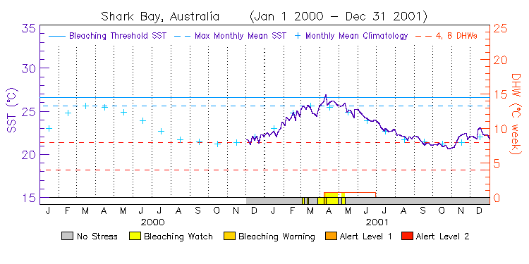
| Shark Bay | 25.5S | 112.5E | 14-15 12-13 10-11 08-09 06-07 04-05 02-03 00-01 | data |
Temperate Region
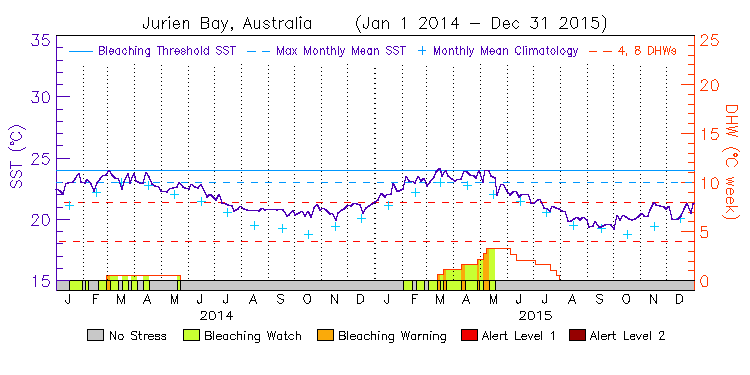
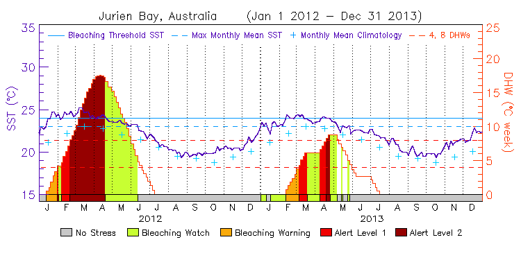
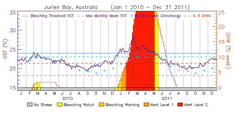
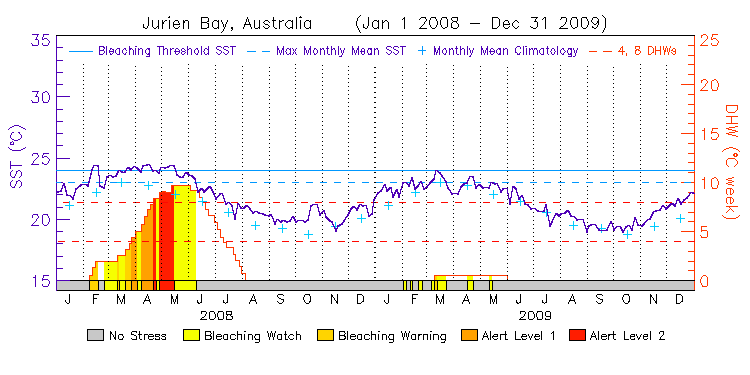
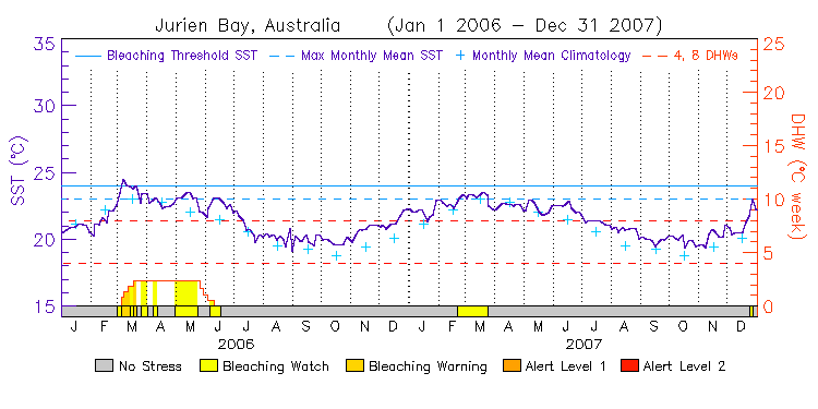
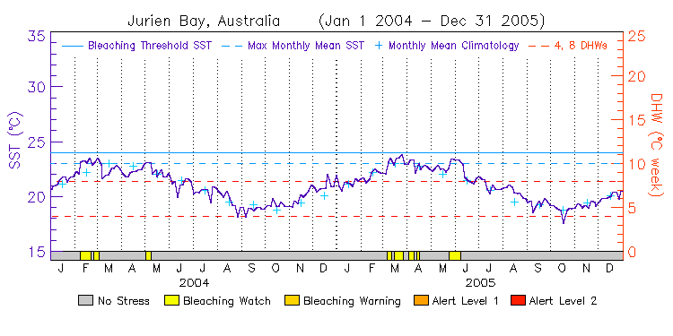
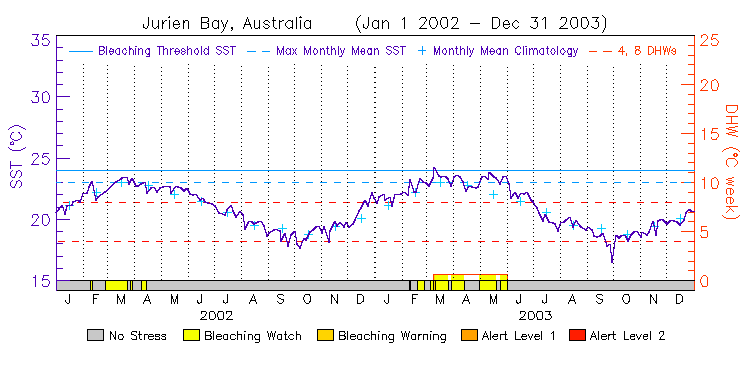
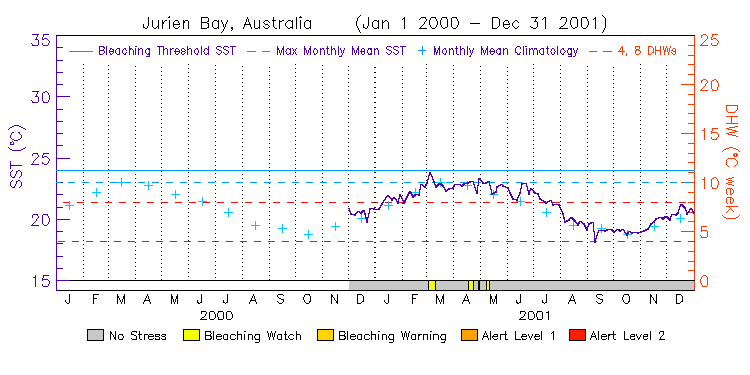
| Jurien Bay | 30.5S | 114.5E | 14-15 12-13 10-11 08-09 06-07 04-05 02-03 00-01 | data |
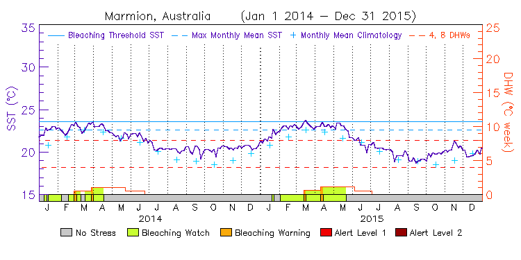
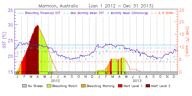
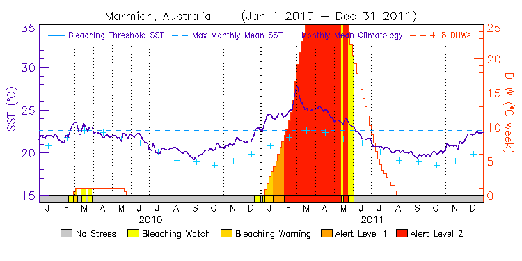
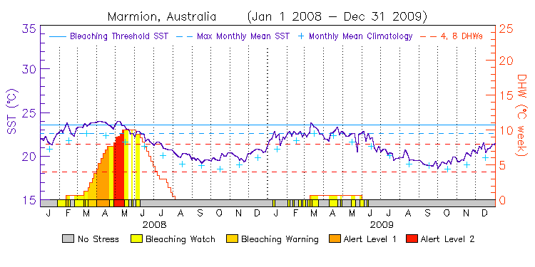
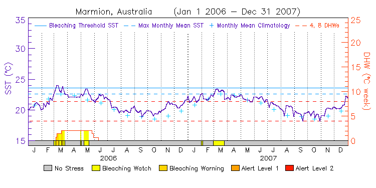
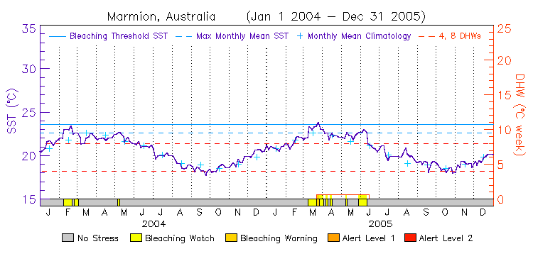
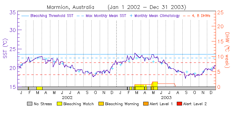
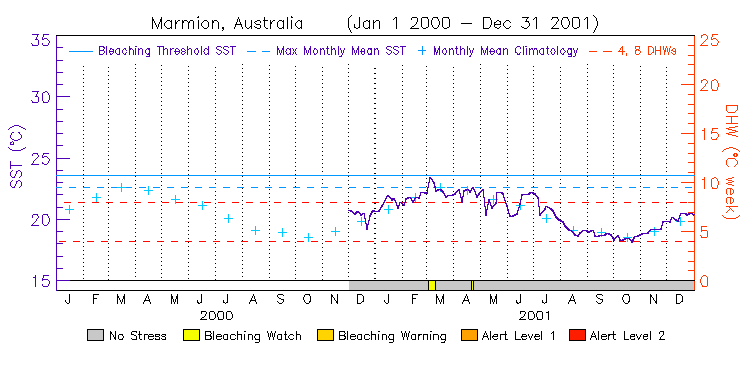
| Marmion | 31.5S | 115.0E | 14-15 12-13 10-11 08-09 06-07 04-05 02-03 00-01 | data |
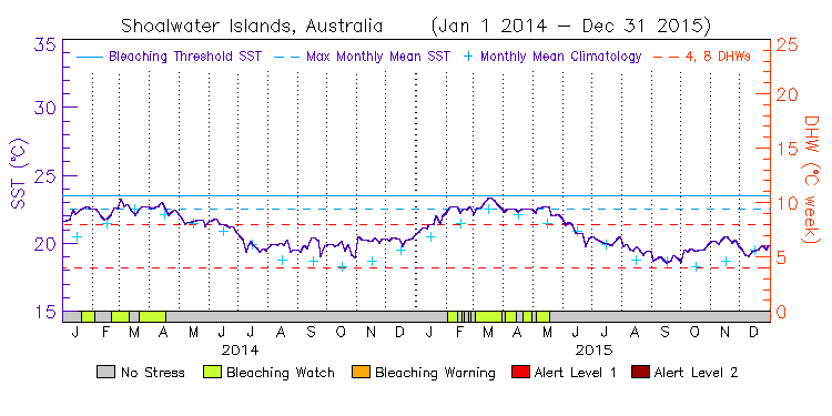
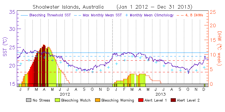
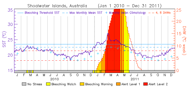
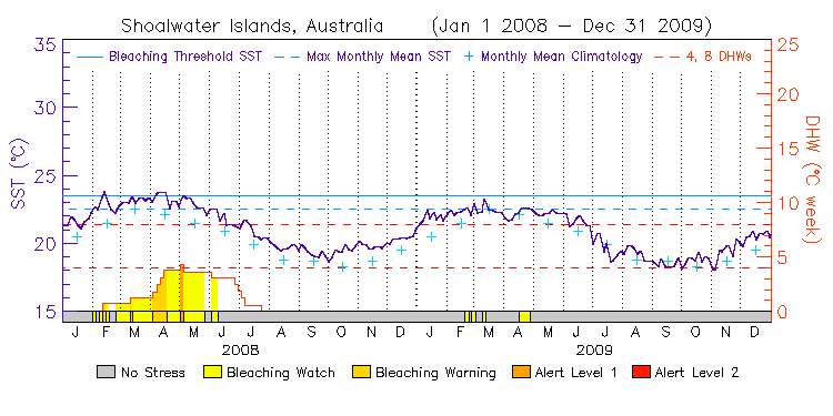
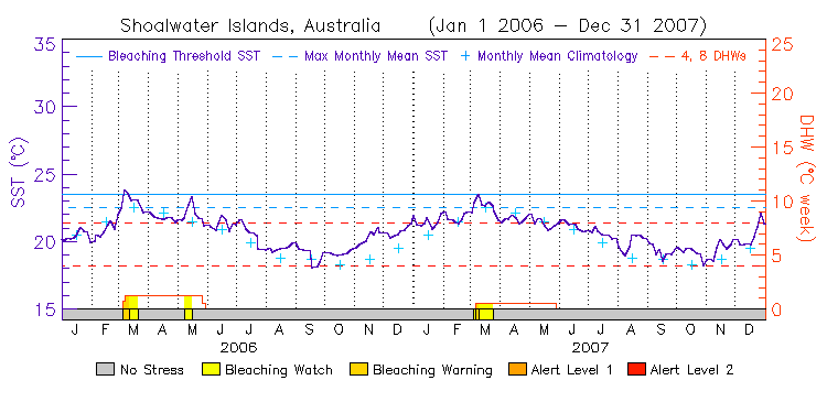
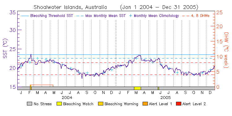
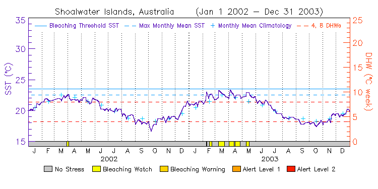
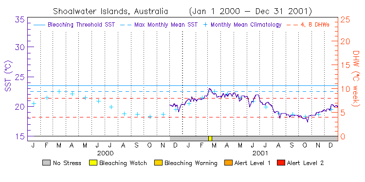
| Shoalwater Islands | 32.5S | 115.0E | 14-15 12-13 10-11 08-09 06-07 04-05 02-03 00-01 | data |
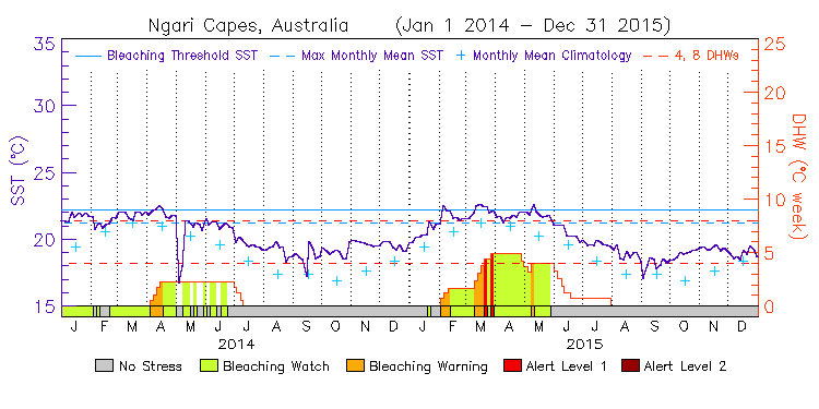
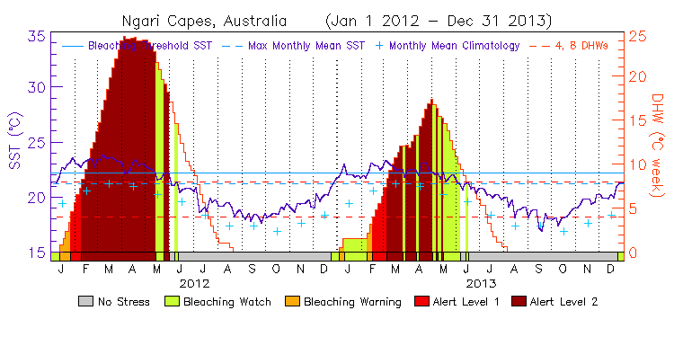
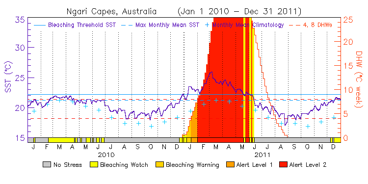
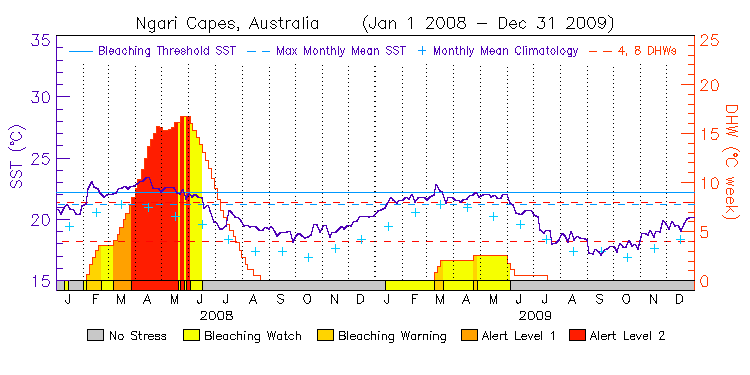
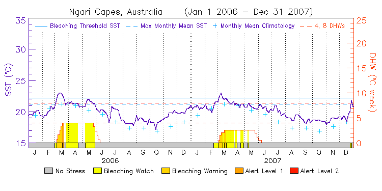
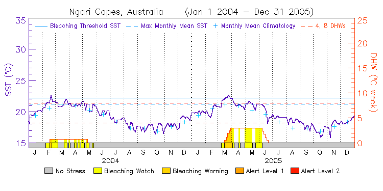
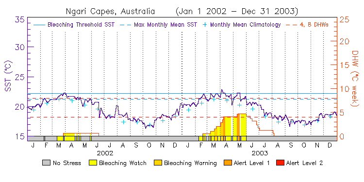
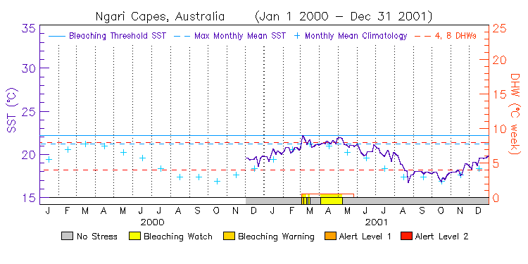
| Ngari Capes | 34.0S | 114.5E | 14-15 12-13 10-11 08-09 06-07 04-05 02-03 00-01 | data |
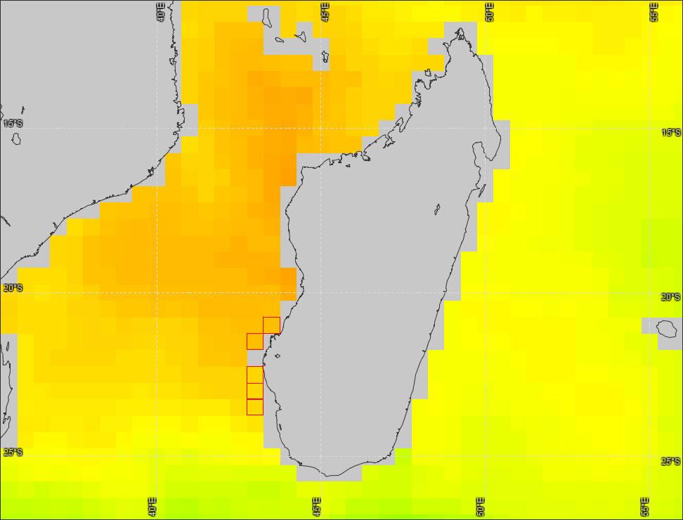
Southwest Madagascar
(5 stations, released on July 8, 2011) ---
Virtual Station Location Map
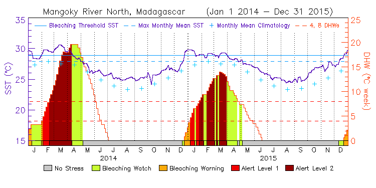
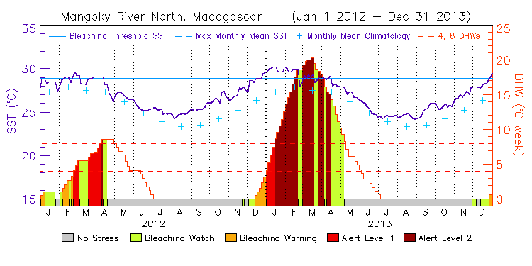
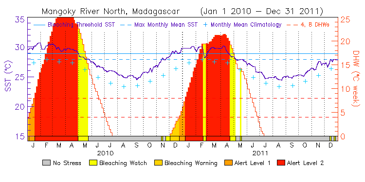
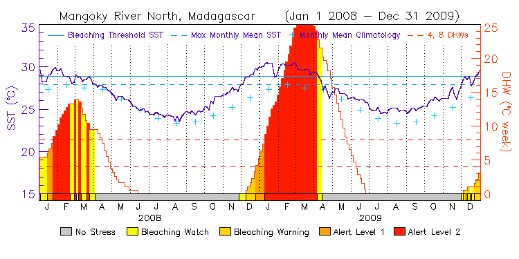
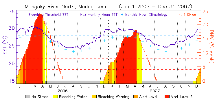
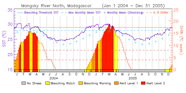
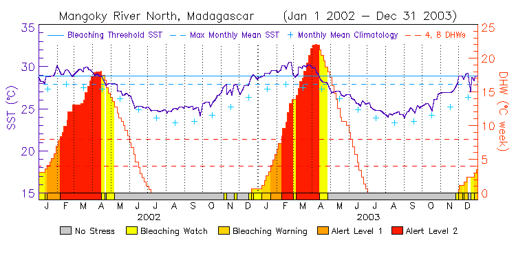
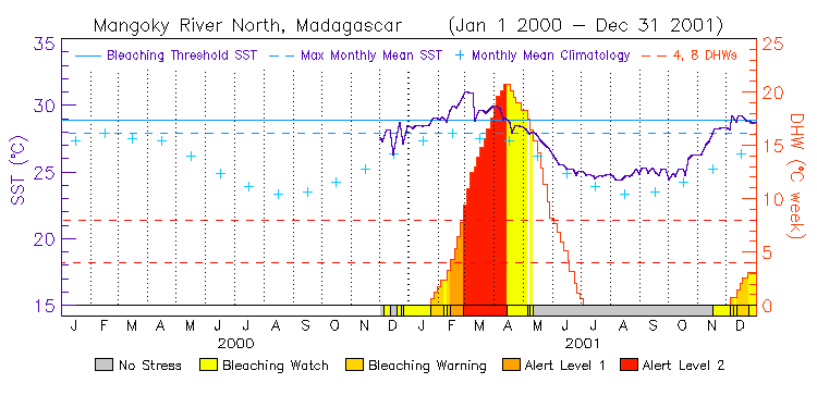
| Mangoky River North | 21.0S | 43.5E | 14-15 12-13 10-11 08-09 06-07 04-05 02-03 00-01 | data |
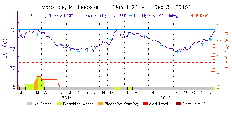
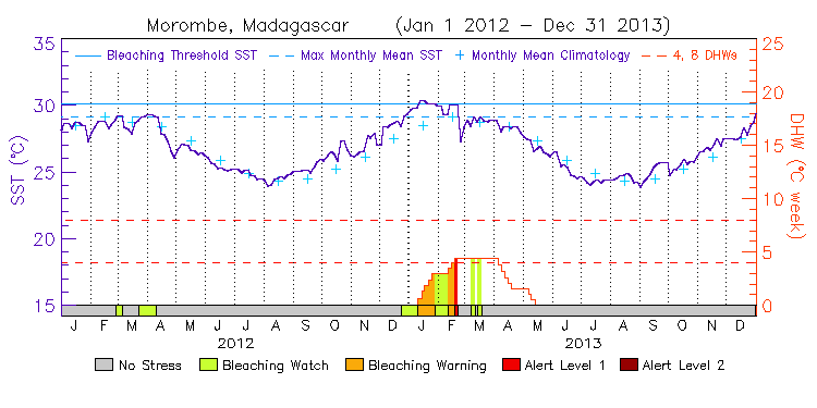
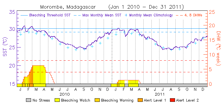
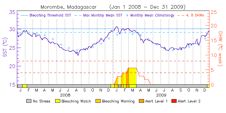
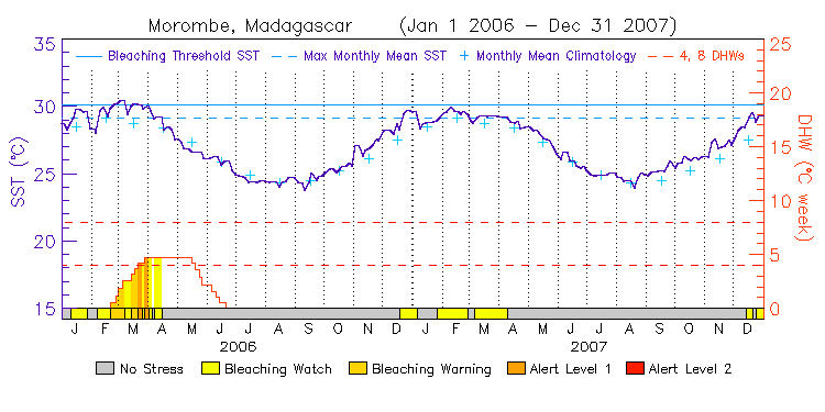
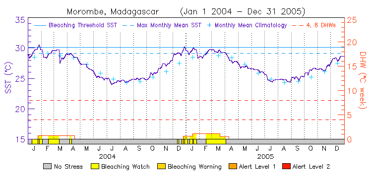
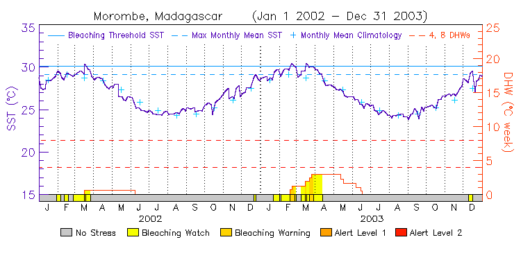
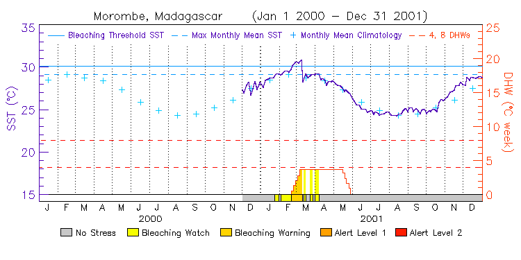
| Morombe | 21.5S | 43.0E | 14-15 12-13 10-11 08-09 06-07 04-05 02-03 00-01 | data |
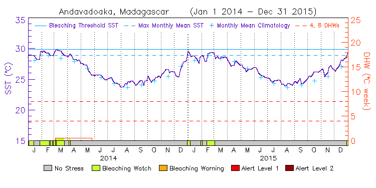
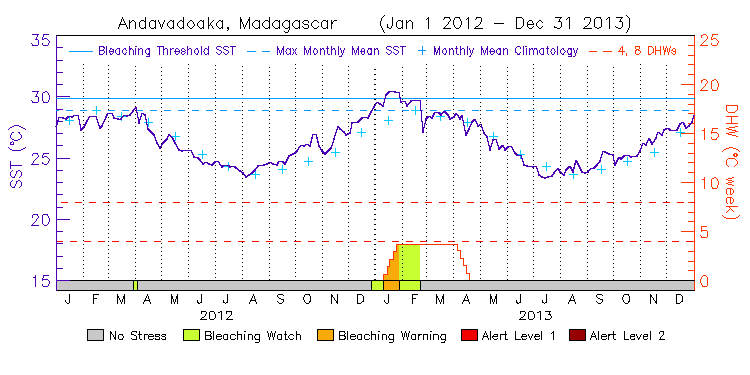
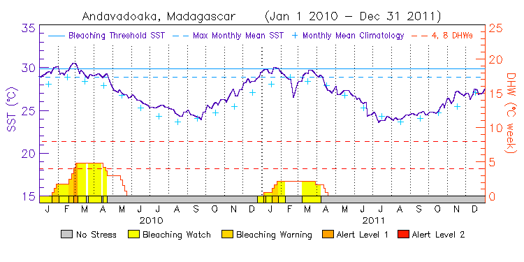
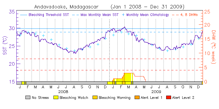
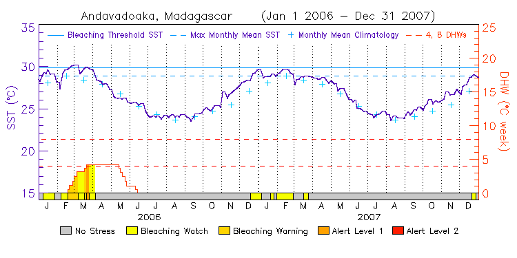
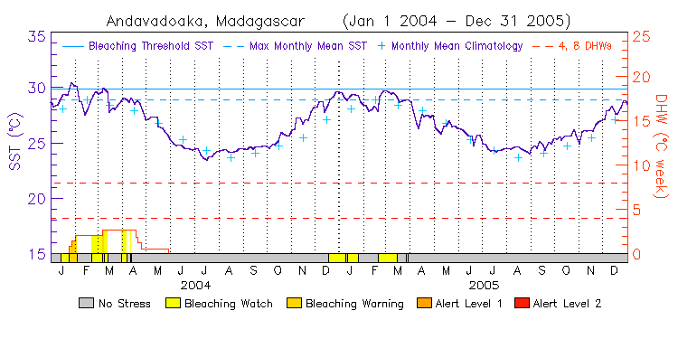
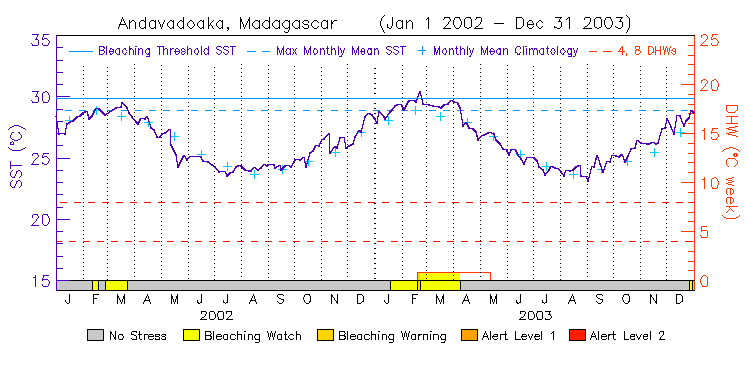
| Andavadoaka | 22.5S | 43.0E | 14-15 12-13 10-11 08-09 06-07 04-05 02-03 00-01 | data |
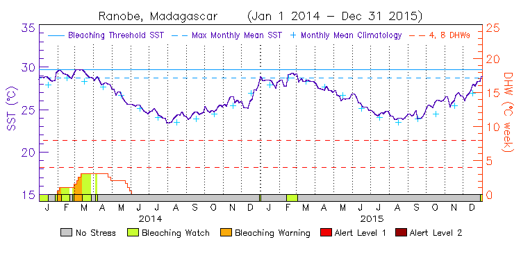
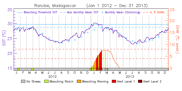
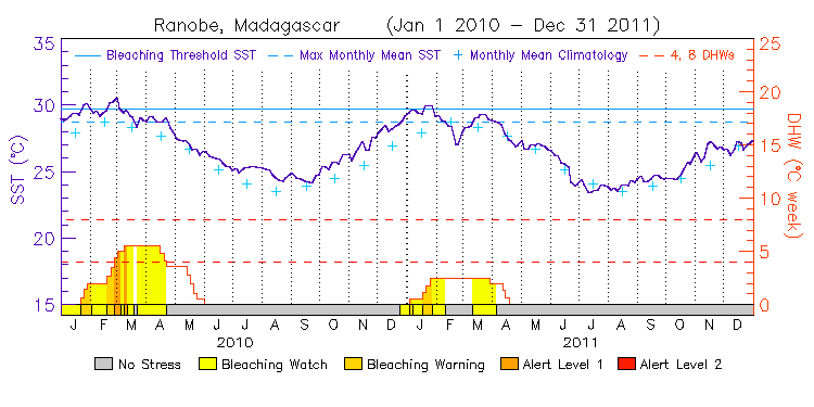
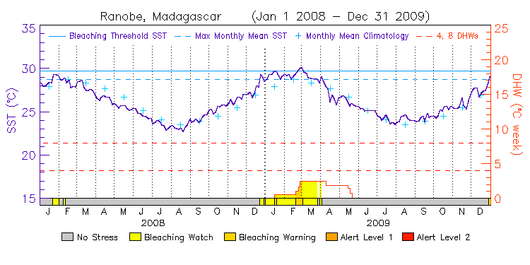
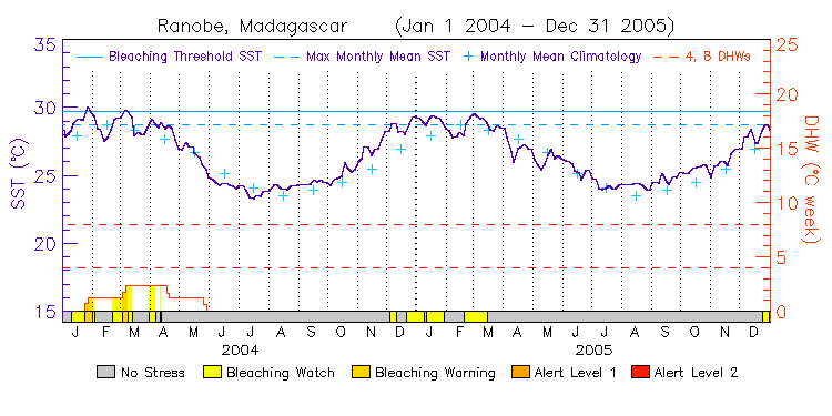
| Ranobe | 23.0S | 43.0E | 14-15 12-13 10-11 08-09 06-07 04-05 02-03 00-01 | data |
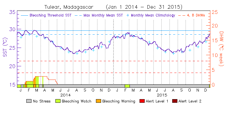
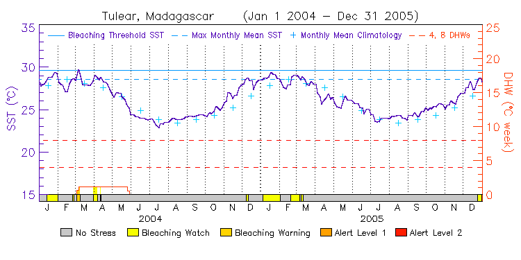
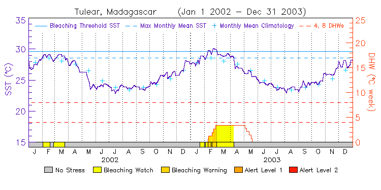
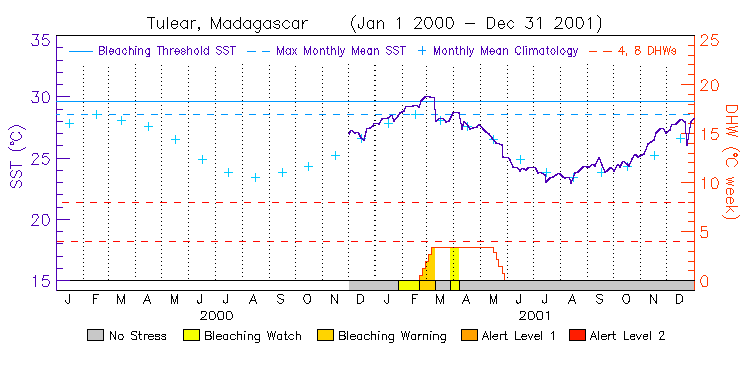
| Tulear | 23.5S | 43.0E | 14-15 12-13 10-11 08-09 06-07 04-05 02-03 00-01 | data |
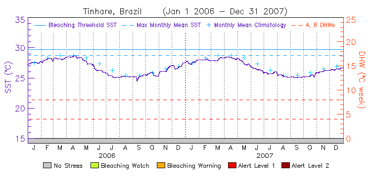
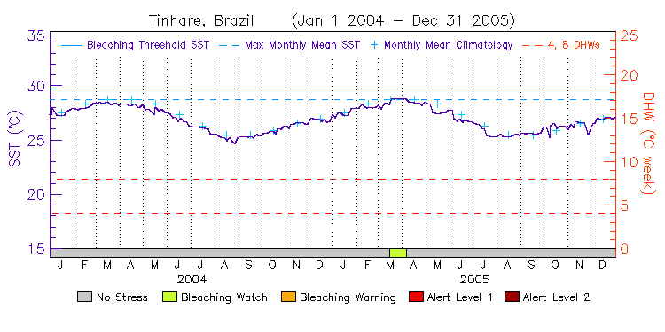
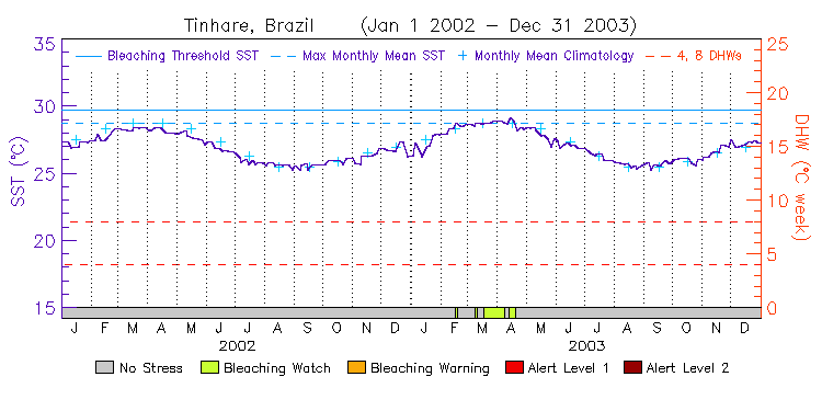
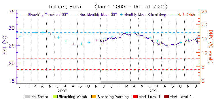
Brazil
(2 stations, released on October 18, 2012) ---
Virtual Station Location Map
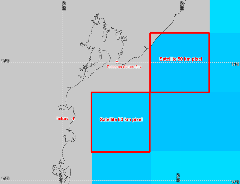
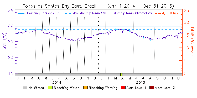
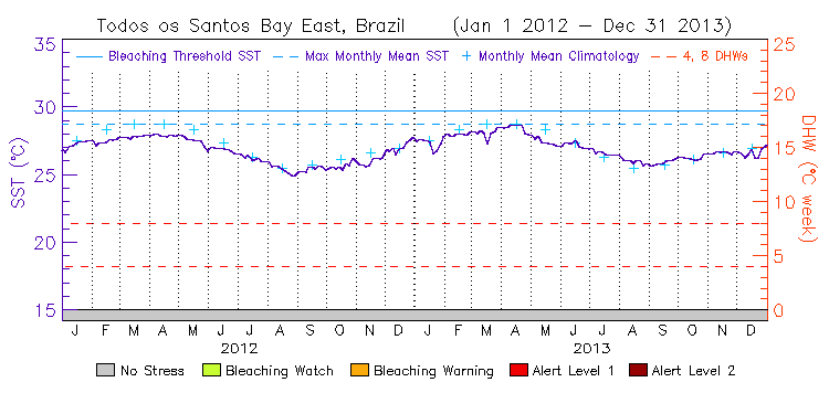
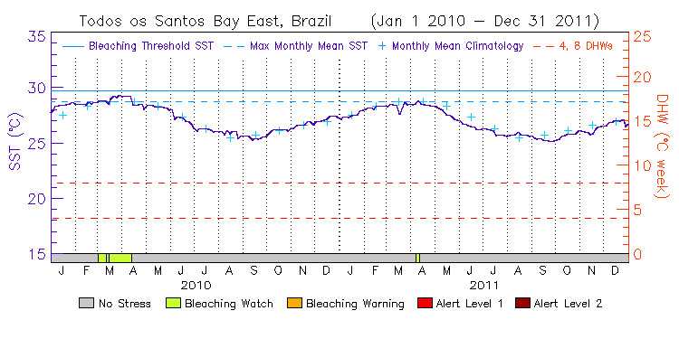
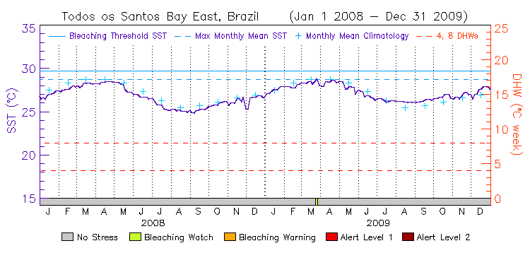
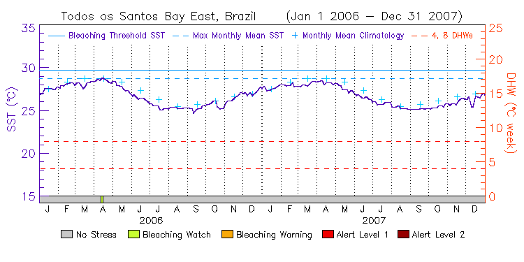
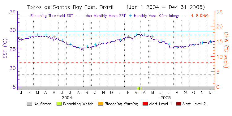
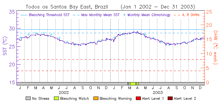
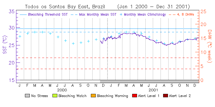
| Todos os Santos Bay - East | 13.0S | 38.0W | 14-15 12-13 10-11 08-09 06-07 04-05 02-03 00-01 | data |
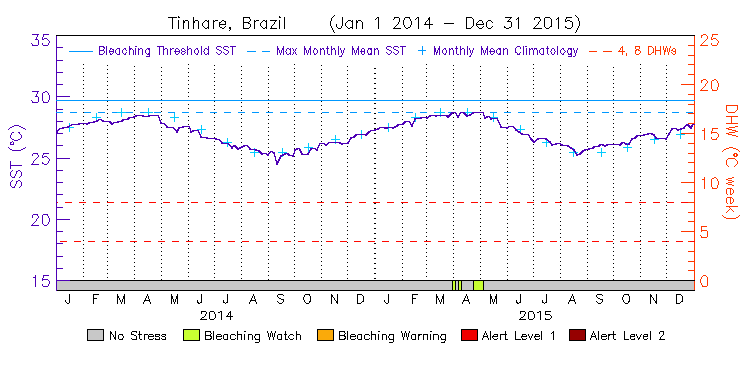
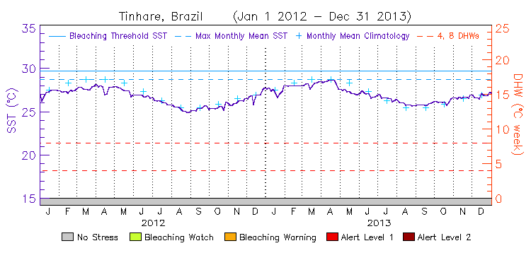
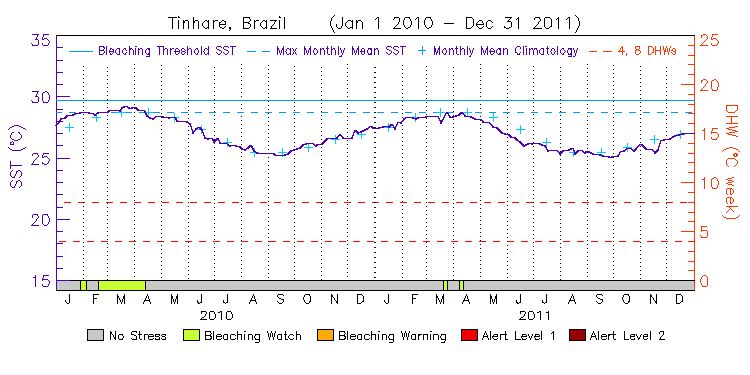
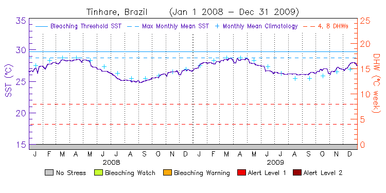
| Tinhare | 13.5S | 38.5W | 14-15 12-13 10-11 08-09 06-07 04-05 02-03 00-01 | data |
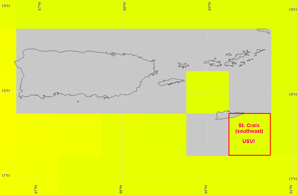
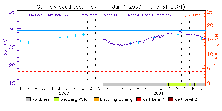
Caribbean
(1 station, released on January 31, 2013) ---
Virtual Station Location Map
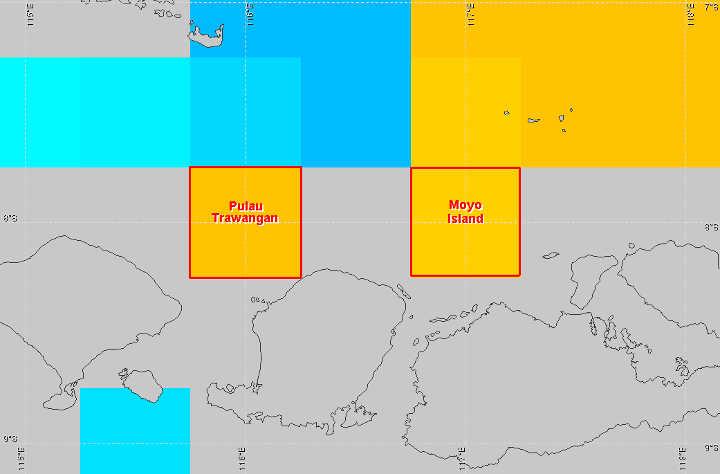
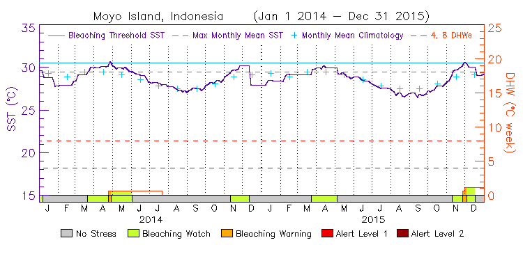
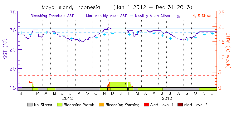
Coral Triangle
(2 stations, released on January 31, 2013) ---
Virtual Station Location Map
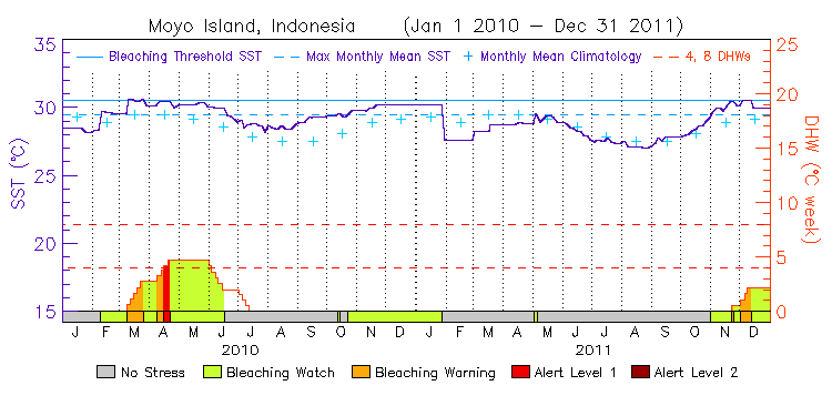
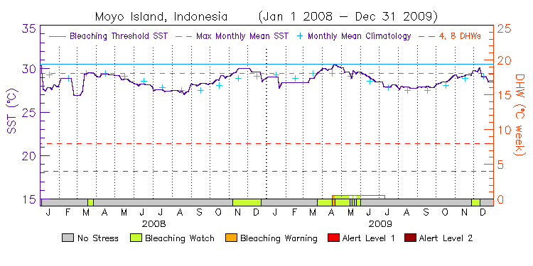
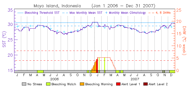
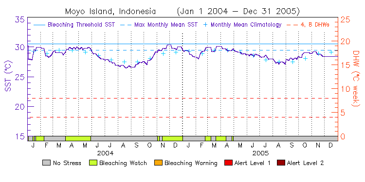
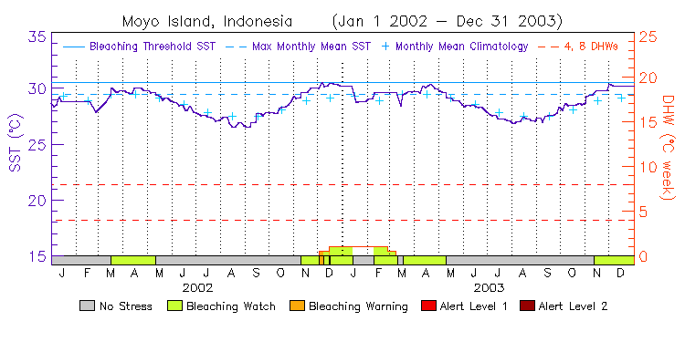
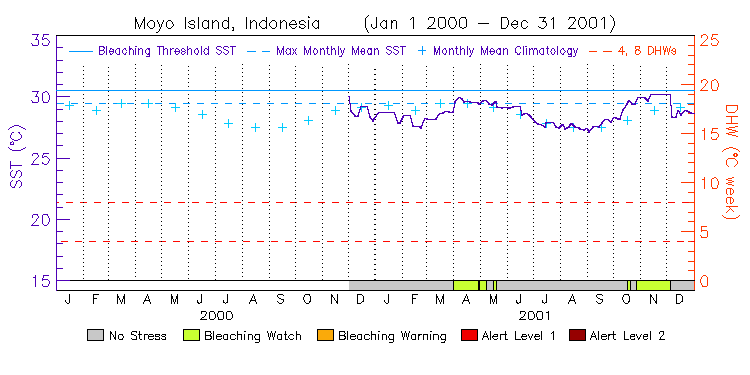
| Moyo Island, Indonesia | 8.0S | 117.0E | 14-15 12-13 10-11 08-09 06-07 04-05 02-03 00-01 | data |
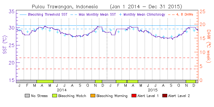
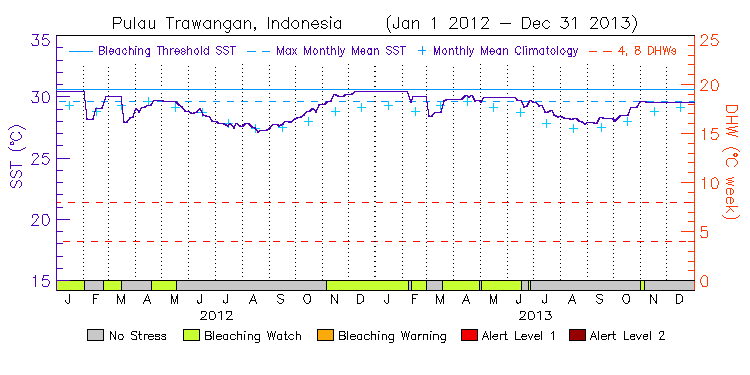
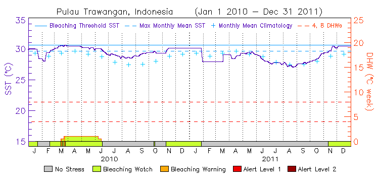
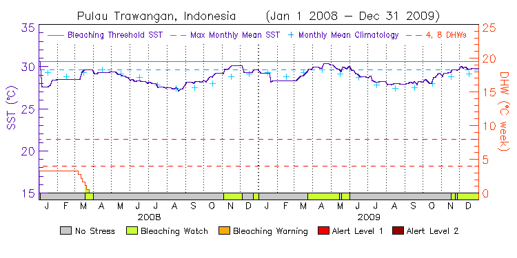
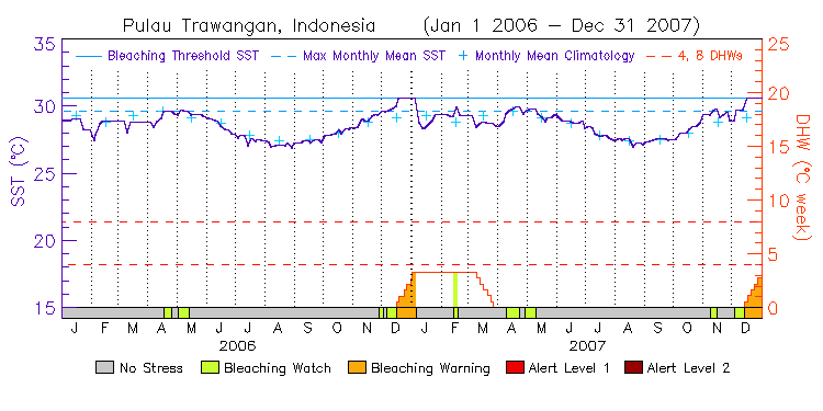
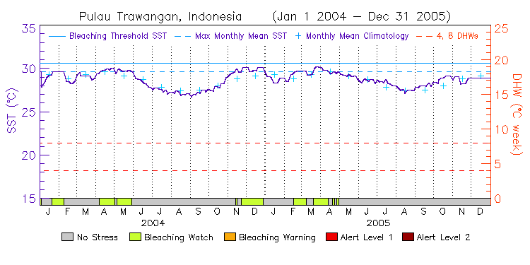
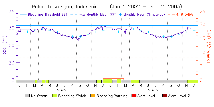
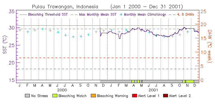
| Pulau Trawangan, Indonesia | 8.0S | 116.0E | 14-15 12-13 10-11 08-09 06-07 04-05 02-03 00-01 | data |
Southeast Asia
(3 stations, released on January 31, 2013) ---
Virtual Station Location Map
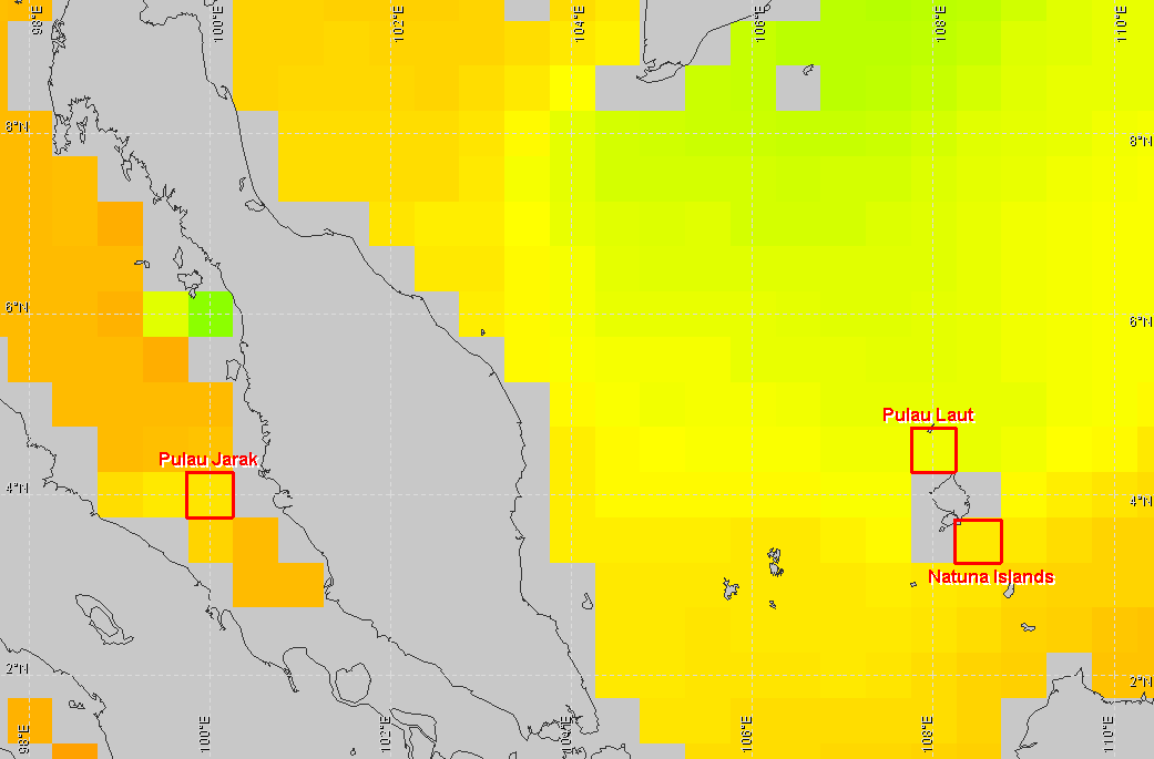
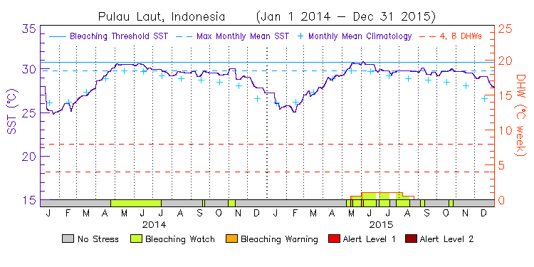
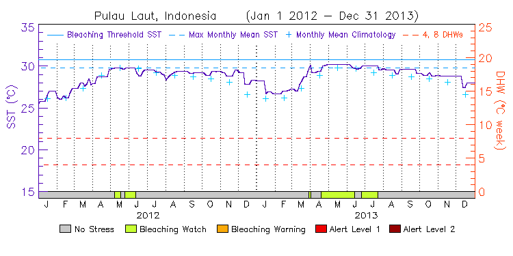
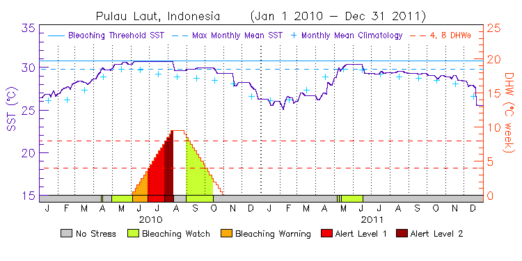
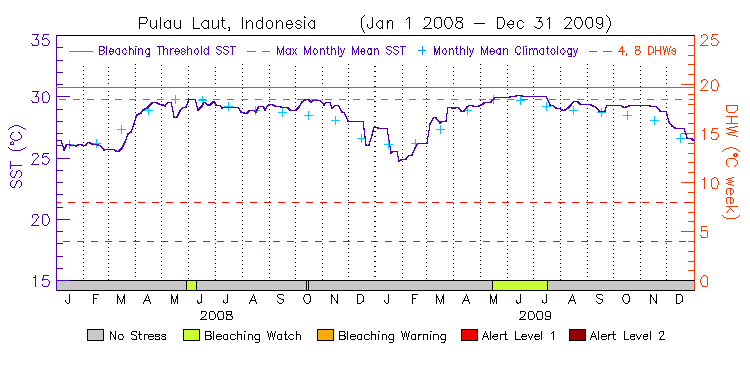
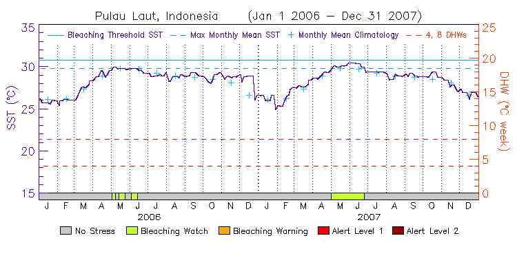
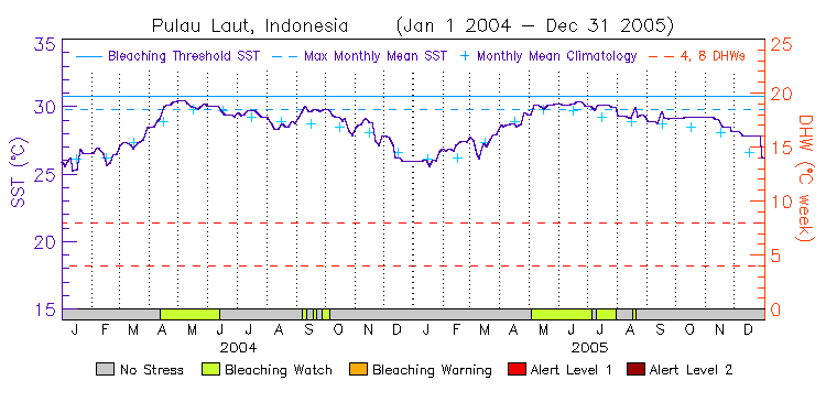
| Pulau Laut, Indonesia | 4.5N | 108.0E | 14-15 12-13 10-11 08-09 06-07 04-05 02-03 00-01 | data |
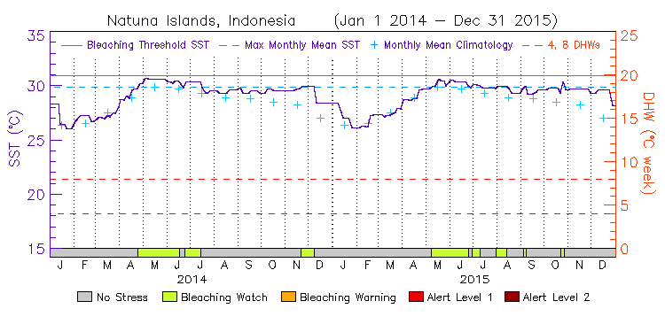
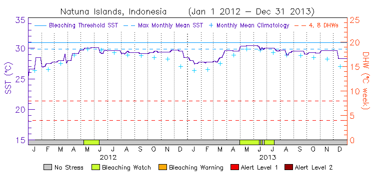
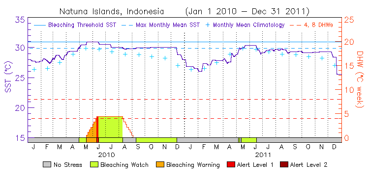
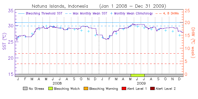
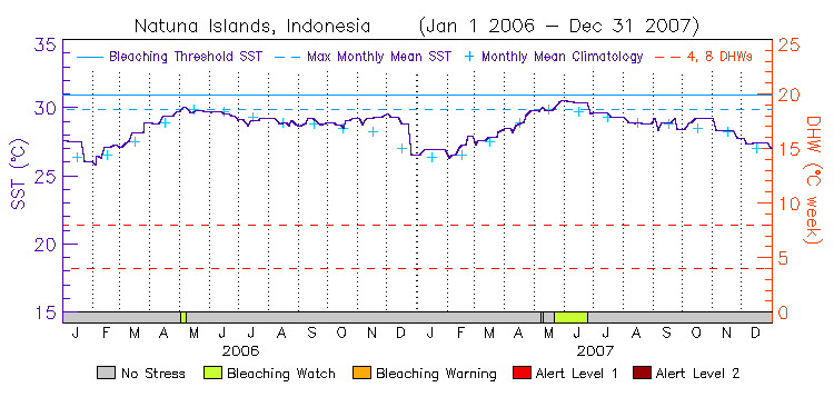
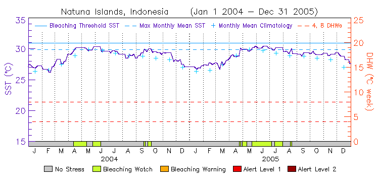
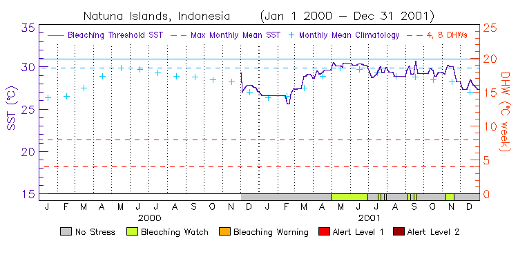
| Natuna Islands, Indonesia | 3.5N | 108.5E | 14-15 12-13 10-11 08-09 06-07 04-05 02-03 00-01 | data |
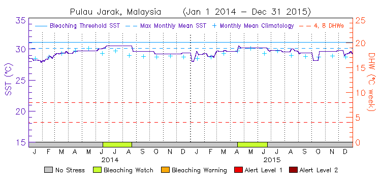
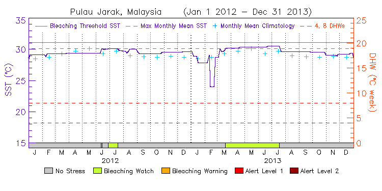
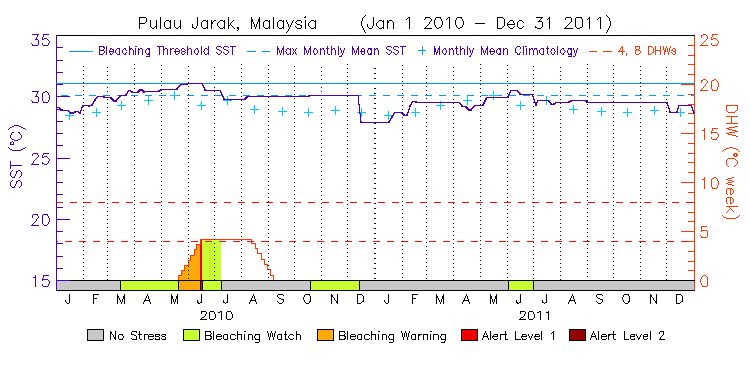
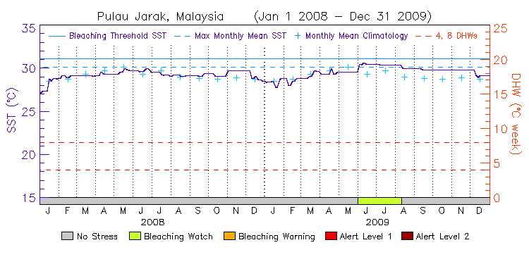
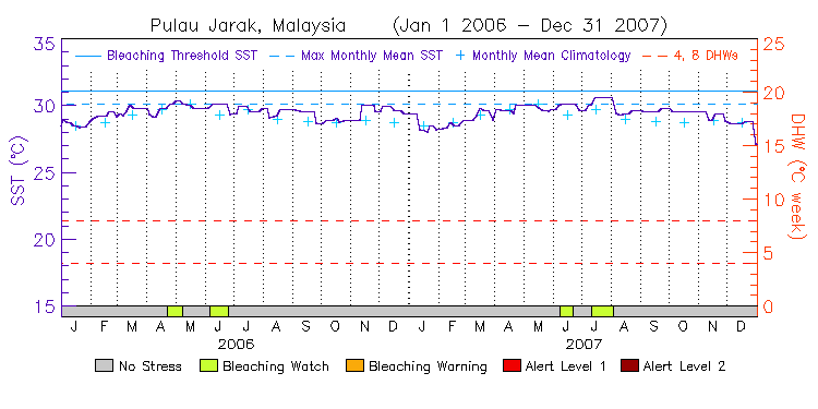
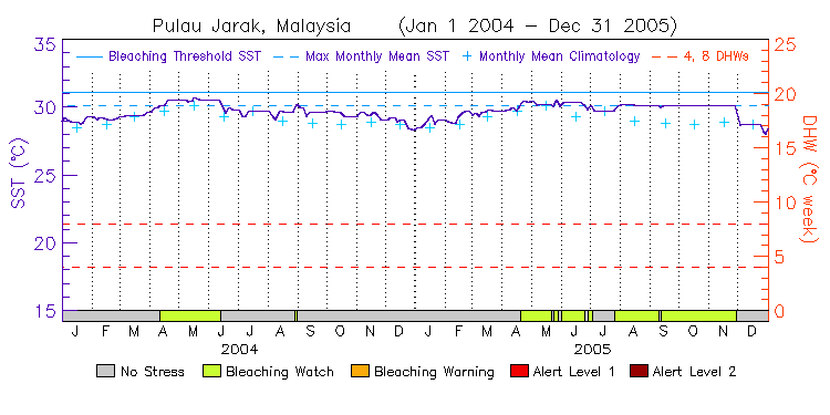
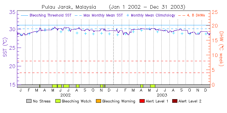
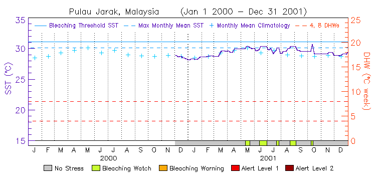
| Pulau Jarak, Malaysia | 4.0N | 100.0E | 14-15 12-13 10-11 08-09 06-07 04-05 02-03 00-01 | data |
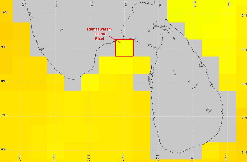
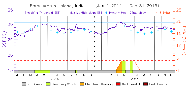
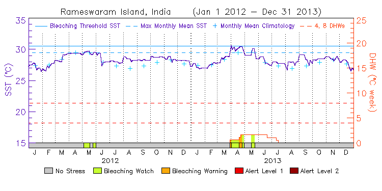
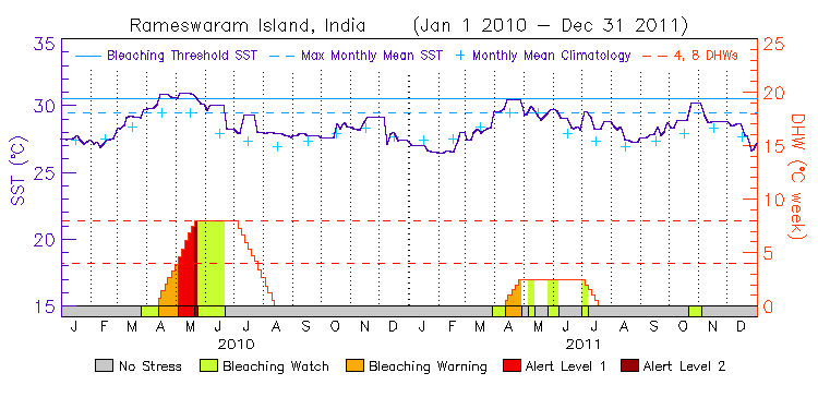
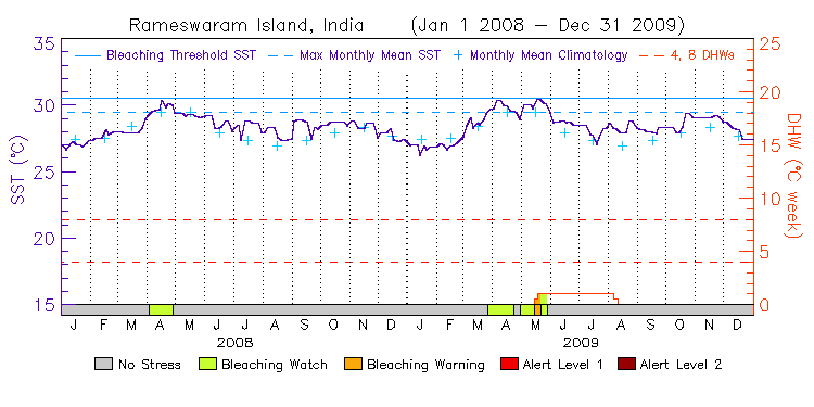
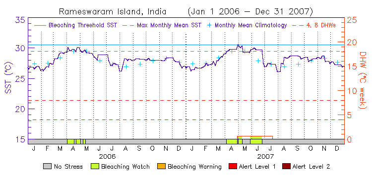
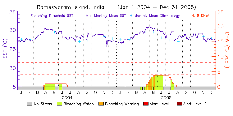
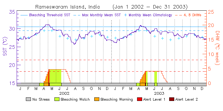
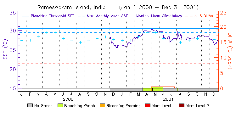
South Asia
(1 station, released on January 31, 2013) ---
Virtual Station Location Map

